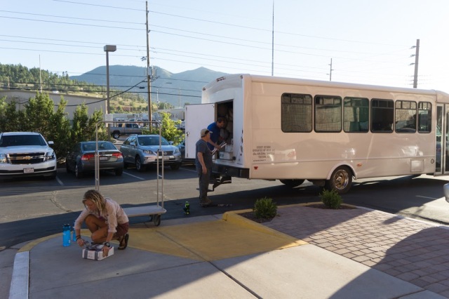
Walking Train Tracks on Superbowl Sunday

20170205_150553

February 4, 2017

It was a warm day for February, mid fifties with a mild wind and overcast skies but no rain. Mid-afternoon, I had an afternoon to kill, waiting for the Superbowl to come on tv, waiting on my daughter, who was dancing at the ballet studio all afternoon and into the evening, (halftime to be exact, before she finished and we could make the hour drive home; she wanted to watch Lady Gaga, so we sat in the lobby of the studio for another fifteen minutes and watched the spectacle).

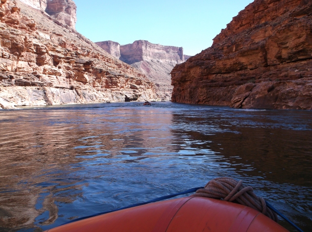
A couple of miles from the studio Two Rivers Park sits at the junction of the Little Maumelle River and the Arkansas River. There’s a big parking area, a boat ramp, and a bicycle/pedestrian bridge that crosses the mouth of the Little Maumelle and connects the Two Rivers trail to the Arkansas River Trail, which runs all the way downtown on the south side of the river and splits to cross the Big Dam Bridge and run into North Little Rock on the north side of the Arkansas. It being Sunday afternoon the parking lot was full and the Two Rivers trail, paved for bicycles, was busy. Railroad tracks ran west, toward cone-shaped Pinnacle Mountain in the distance, the tracks squeezed between a steep bluff and the Little Maumelle River. Opting for time away from crowds, I followed the tracks and soon found myself alone, following the curve of the rails as it paralleled the curves of the river.

I’ve got a history with railroad tracks dating back to my early teenage years, when a friend and I used the tracks near his house to get out of the neighborhood he lived in and into what passed for near-country despite being in the middle of a mid-sized Mississippi town. We’d lay our ears on the rails and try to detect approaching trains, like American Indians or train robbers in the movies, but never really heard anything even when we could see the big diesel engines a quarter mile down the track. We’d lay coins on the rails and wait for the train to flatten them into silver and copper pancakes. We’d collect rusted railroad spikes and look for blue-glass insulators at the base of utility poles that often ran beside the tracks. The benefit of railroad tracks is that they usually go cross-country, where highways and streets seldom seem to go. Unlike cars, trains don’t need to stop, or turn off or lead to houses or businesses, so in just a few minutes of walking, it can feel like you’re miles from nowhere. Traffic noises dissipate, trees crowd up close to the right of way, and the gentle curves provide an incentive to find out what’s around the next bend. Walking the rails, I’m reminded of Hemingway’s young hero Nick Adams, walking the rails and riding the trains to get away from something, or to get somewhere new and promising.

In college I rented a room in a house that sat on the edge of town. Behind the house railroad tracks led off into the country, and beside the tracks for a long way was a nice creek with steep banks and wonderful hardwoods. Across the creek stretched the experimental farmland of Mississippi State University’s College of Agriculture, several hundred acres. Afternoons I would gather my books and head off down the tracks and walk as far as I wanted until I found a nice place to study in the woods that sheltered the creek.

Despite the peaceful setting, passing trains never failed to excite the little boy inside of me. The deep throb of the diesel engines, the wave of the engineer, the screeching metal-on-metal of the wheels, remind me of the excitement Walt Whitman felt in his poem, “To a Locomotive in Winter”:

. . . .
Fierce-throated beauty!	 
Roll through my chant with all thy lawless music, thy swinging lamps at night,
Thy madly-whistled laughter, echoing, rumbling like an earthquake, rousing all,	  
Law of thyself complete, thine own track firmly holding,	 
(No sweetness debonair of tearful harp or glib piano thine,)	 
Thy trills of shrieks by rocks and hills return’d,	
Launch’d o’er the prairies wide,across the lakes,	 
To the free skies unpent and glad and strong.

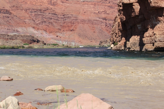
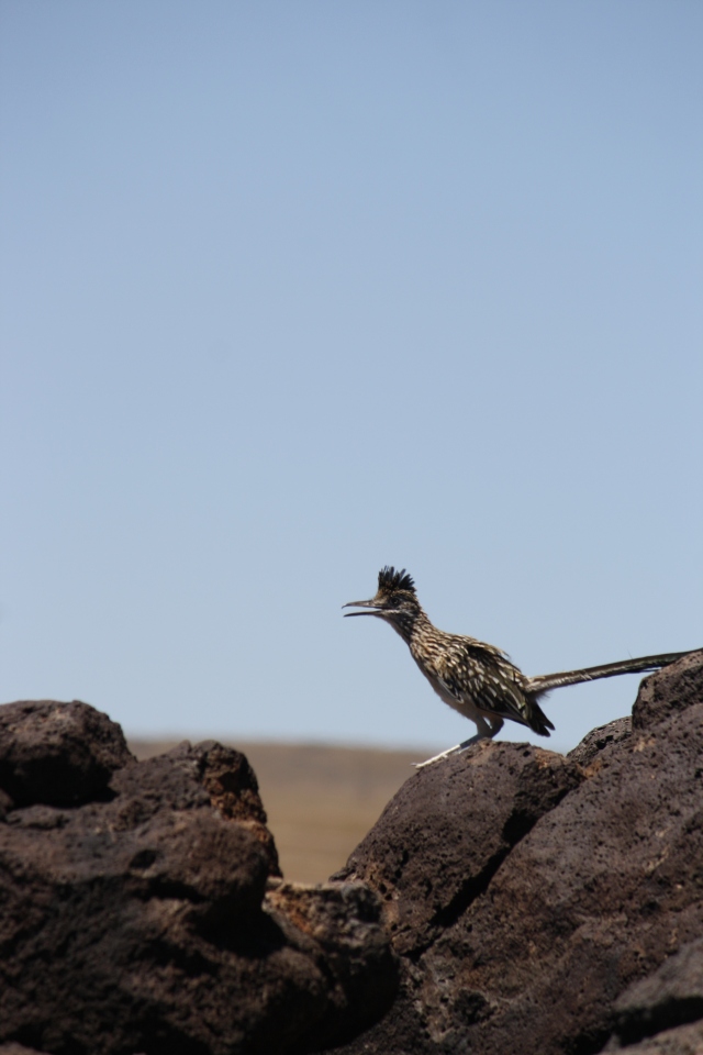
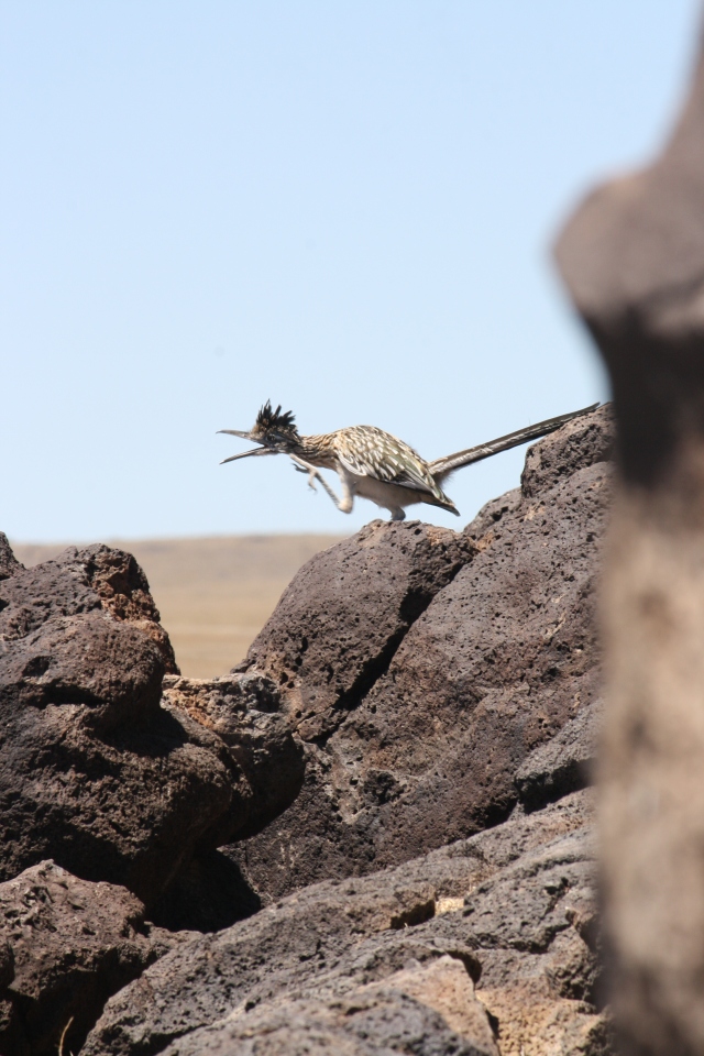
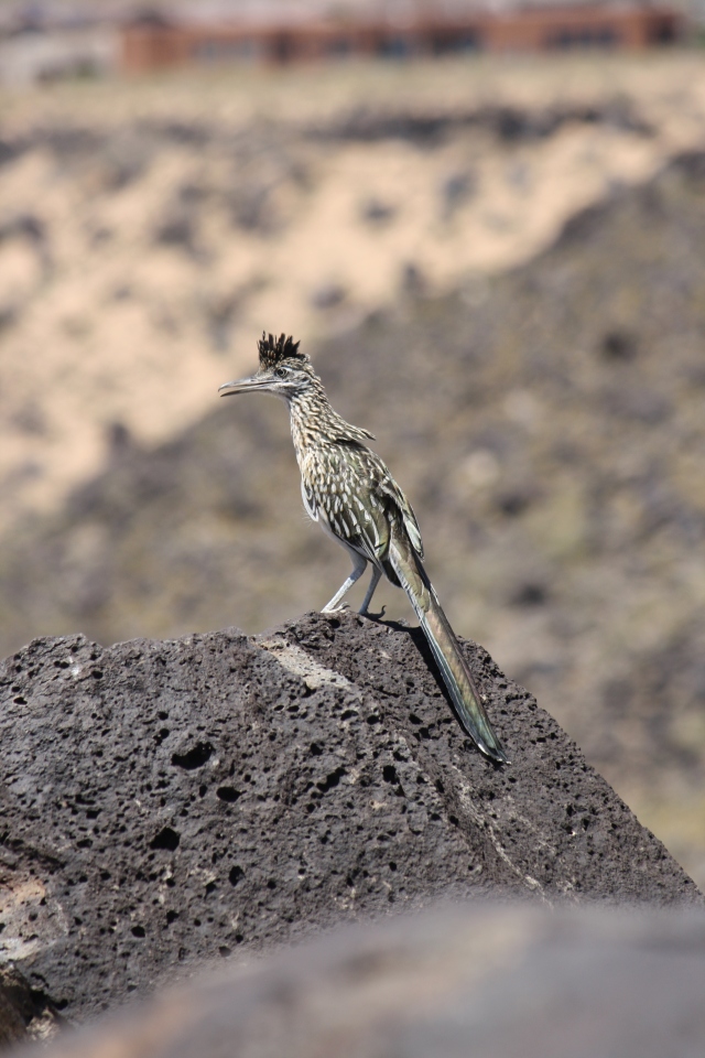
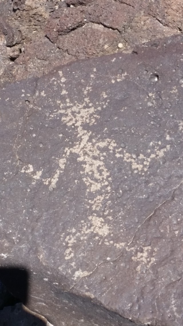
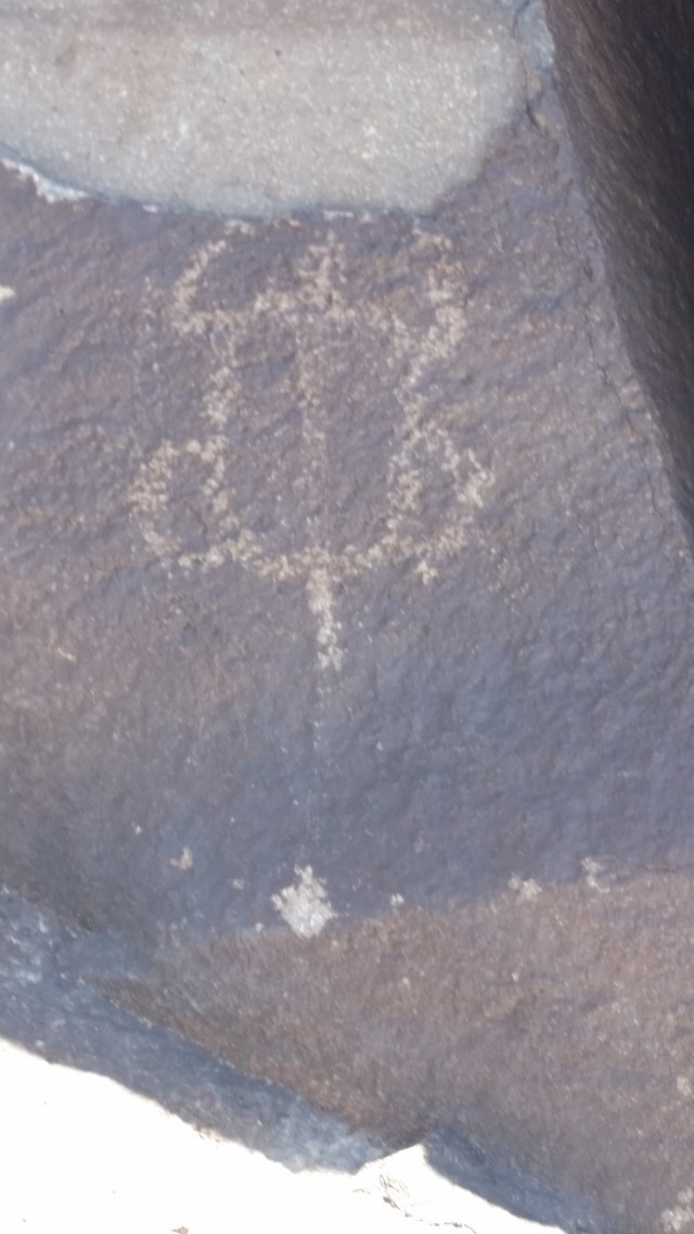
Although there were no trains running today, it was pleasant to be outdoors. The Little Maumelle, about 40 yards wide at the mouth, narrowing to twenty by the time I had hiked two miles, barely registered a flow as it was backed up behind Big Dam Bridge. But the tracks were covered in fallen leaves, oak and hickory, and fat acorns had dropped between the ties. I tossed a few tie spikes and some rusted bolts into the river to hear the deep splash. The bluff towered above me on the left, a couple of hundred feet in places, and at the end of my walk I came upon a small marina on the far bank, with a tiny houseboat built on a small barge, and I watched a fat dog waddle down the gangplank onto the boat. In the marina a pontoon boat sported a confederate flag. I turned back toward the park where my car was, and as I walked back a few squirrels scampered across the tracks and up on the ridge a deer walked through the trees, silhouetted against the sky behind him.


Colorado River through the Grand Canyon: A Photo Essay

I’m still working on my reflections of the summer trip through the Grand Canyon. Here are a few random pictures that I haven’t shared yet. More detailed journals of the trip will follow soon.


dscf1060

Julia Rose scouting the rapids on day 1.

dscf1066

Collared lizard

dscf1200

dscf1103

dscf1229

Early morning shade.

dscf1299

Lunch stop.


The Grand Canyon/Colorado River Oar Trip: Day 3, Part 2

dscf1288

July 16, 2016

The stretch between Sandpile campsite and Saddle Canyon is relatively flat, with few rapids and none of any real consequence. What keeps our attention at lunch and during the afternoon is the growing cloud of smoke coming off of the North rim Fuller Fire, which started from lightning a few days before our trip began and which closed some areas at the North Rim park where Lisa and Stella are staying. (They will tell us later that there was a heavy firefighter presence in the park, with choppers coming and going, and some road blockages.) The fire was initially located 3 miles west southwest of Point Imperial, and July 7 was only 1 acre. The NPS elected to let it burn in order to clear out accumulated fuel and prevent a larger scale fire in the future. As of July 29 the fire had affected 14.5 thousand acres, with the NPS letting it burn because there had not been a “natural ignition” in over 200 years.

dscf1301

Smoke from the Fuller Fire begins to dominate the sky above the rim at the lunch stop.

dscf1303

Under the canyon rim at lunch.

The fire is only been a few miles away from where we are boating, but up on the rim, and the constant change of direction caused by river bends keest us close to the downwind smoke. The smoke builds all day long so that at lunch the sun barely shines through the haze, turning it bright orange, and big pieces of soot fall on us as we floated. At times a thick pall of smoke hangs above the river, bringing up many allusions to the surreal scenes in Apocalypse Now where a thick smoke haze covers the river, making it almost impossible to steer. If it had been an actively fought fire, though, chances were high that we would have seen choppers coming to the river to scoop water to fight it.

dscf1309

dscf1314

Although the smoke never gets so bad for us that finding our way down the river is an issue, we did have a good time conjecturing where the fire was and how big it was, and tossing out Apocalypse Now quotes: “Never get off the boat!” “Got to be some mangos around here somewhere”; “Do you want to raft or fight?” and, “Grand Canyon: Shit” (the last one I thought, rather than said, since my daughter was sitting next to me on the raft). As always, when Julia Rose finds me in the rare company of movie-literate people who get my quotes, she is always surprised, suddenly seeing me in a different light.

dscf1316

dscf1318

dscf1331


dscf1347

dscf1348

In addition to the smoke, we begin to see a few clouds, where before there had been pristine blue sky. According to Ethan, it might be the signal of monsoon season coming on, a July/August phenomenon where moisture gets funneled up from the gulf of Mexico and brings rain.

dscf1334

Ethan fights the wind a good bit of the day. At times he has to point the back of the raft downstream and just flat out row to make any progress at all. We camp for the evening around mile 48, at Saddle Canyon in a big eddy that separates the upper and lower campsites. A motorized raft group has the Upper Saddle Beach, and we take Lower Saddle.

dscf1356

After setting up camp Omar leads the group on a long hike up Saddle Canyon. It’s 4.5 miles round trip, and we climb pretty steadily and gain a few hundred feet in elevation quickly. It is a good test for my knee.

dscf1360


dscf1361dscf1364
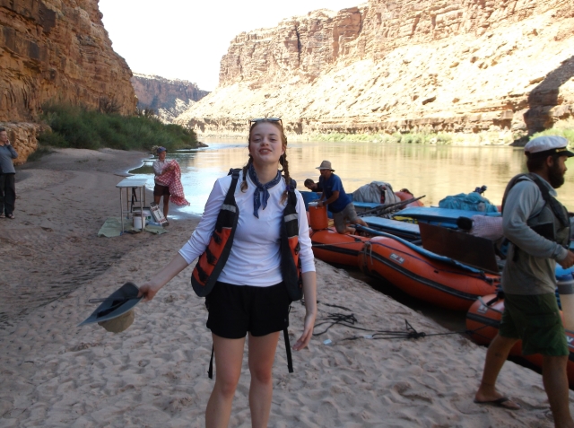
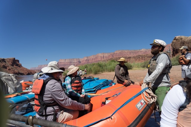
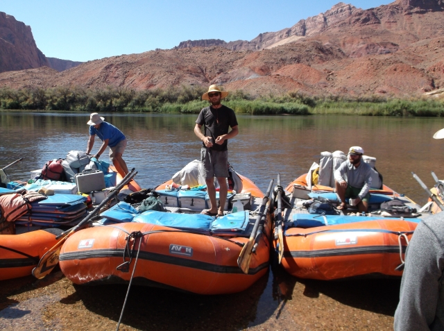
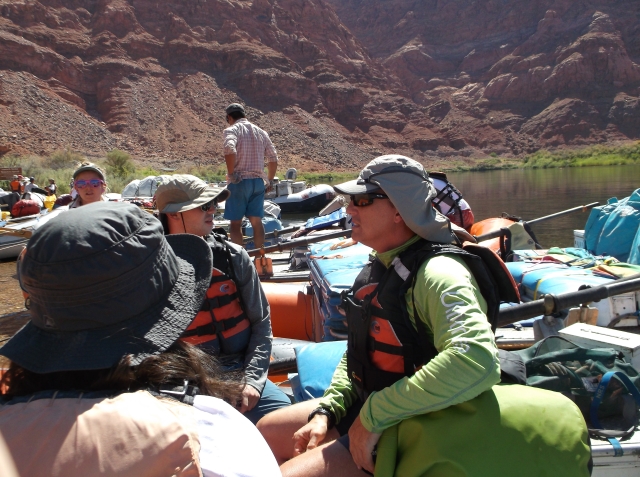
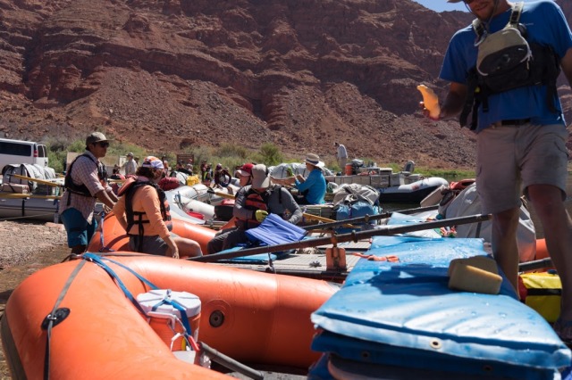
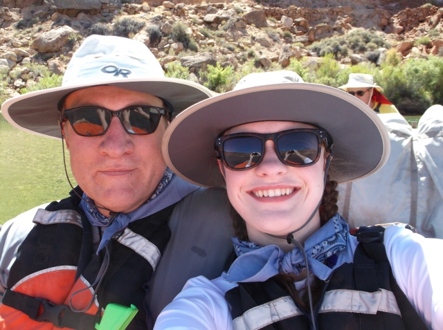
At first we walk beside the creek, then cross it several times, and in sections have to wade upstream. The temperature cools (if you want to call high 90s or low 100s cool) as we are in the shade of the canyon walls and the canyon itself sprouts lots of vegetation, including trees and shrubs like Western Redbuds, Coyote Willow, Mesquite, Cat’s Claw (the “wait-a-minute” bush, because the thorns snag clothing and force walkers to stop and disentangle themselves), and Netleaf Hackberry, adding to the deepness of the shade.

dscf1367

The smoke dissipates as we climb higher, and we pass through desert scrub into a slot canyon that narrows as we climb higher.

dscf1371

dscf1372

dscf1378

We end up in a beautiful slot roughly 6 to 8 feet wide and blocked off by a high cliff. We dip in the waist deep pool and relax on the rocks for a while, before beginning the long walk back, where we get to camp just before supper: Beef and chicken tamales, quesadillas, and rice.

dscf1377

dscf1383

It’s a tiring day–the combination of sun and smoke and long slow floating with few rapids to break up the slow pace leave us tired. I’m too tired to journal and almost too tired to read. I can usually manage a few pages of Edward Abbey’s Desert Solitaire, appropriate for Canyon country, before getting sleepy, so I switch to Farley Mowat’s And No Birds Sang, a memoir of the Canadian forces invasion of  Sicily and Italy during WWII. It’s a change of pace from the canyon and I hope it will keep me interested enough to stay up a little later and wait for the heat to lift. I know Desert Solitaire by heart, so I don’t feel cheated. I’m not the only one with an Abbey book on the trip. Elana, the girl who’s just graduated college and has befriended Julia Rose, is reading The Monkey Wrench Gang, though she has just started and we never really get a chance to discuss Abbey. The raft guide Dave says it’s an unusual trip when no one brings Abbey to read.

dscf1228

The Grand Canyon/Colorado River: Day 3, Part 1

July 16, 2016

dscf1237

Ethan, the trip leader, at rest.

dscf1212

Guides at rest after a day of rowing; the kitchen area is unloaded, but not set up yet.

For Day 3 we follow the established wake up and breakfast routine, then pack and load the boats. Today we ride on Ethan’s boat. Ethan is the trip leader, and since we haven’t been on his boat yet, it’s been a bit hard to get a good read on him. He’s young, and later on the trip I’ll be surprised to find out he’s only 24. He’s been working on the river for the past 7 years, starting as a swamper and working his way up to trip leader. He is quiet in camp, though not on the boat, good natured, calm, and extremely competent on the oars. He tells some good stories about the various trips he’s been on, including a trip with Jane Fonda’s daughter, and another trip with an honest-to-god crazy woman in full-blown crazy. He’s got a good sense of humor.

Riding with us, we get Ken for a second day, keeping busy snapping photos and telling stories about the Everglades and other places he’s visited. In the back of the raft ride Cory and Laura, a heatlthy-middle-aged couple who have only been married for a year or so. They are an easy going couple, fairly athletic, and good camping companions. Laura straps on a  whitewater helmet with a Go-Pro camera strapped to the top for filming the rapids.

dscf1238

Climbing up to the Puebloan dwelling site.

dscf1240

The best part about riding in Ethan’s boat is that we are first on the river, and first at whatever stops we make. We push off a bit early while the swampers finish loading the Duke and the rest of the kitchen gear and float a short distance to an ancient American Indian site. We beach the rafts and climb steep trail up a short cliff to a bench of land a couple hundred feet above the river, where Ethan leads us to the outlines of a couple of small structures, rock wall foundations laid out in rectangles, along with some petroglyphs and small flakes of turquoise, which was apparently traded from Mexico and other faraway locations. The structures themselves are smaller than 10 x 10 feet, and there are no higher than a couple of levels of rock. Ethan tells me that there are some more dwellings in the cliffs above us, but it would be a good hike. He had worked here before, for several days, helping a group of archaeologists from the National Park Service catalogue the sites in the area. The NPS used to run their own boats and employee their own “boatmen” on the river, but they’ve taken to using commercial companies because of problems with the boatmen (more to come on that topic).

dscf1243

On the bench, looking at the ruins.

Ethan fills us in on what the archaeologists know about the people who built these structures. The sites we’re looking at date to around 1100 AD, but the ancestral Puebloan people probably came to the area around 800 AD, according to the Grand Canyon River Guide. Good weather allowed for a fairly heavy population to farm the interior of the canyon, and the sites we are seeing are evidence of a shift from living in shallow pit houses. But these remains were probably above ground pueblos. According to the guide, “the pueblo people constructed hundreds of living sites containing single-to-many room dwellings, religious structures, rock-terraced agricultural fields, cliff graneries, rock-lined roasting pits, petroglyphs, and pictographs.” The sites we are seeing allowed the puebloan people to cultivate larger fields on the benchlands and avoid the spring floods of the river.

dscf1257

Ethan shows us a rock the size of a compact car, where the surface is etched with petroglyphs. The rock itself is pretty exposed, so the pictures are weathered.

dscf1256

One of the guides tells us about a spiny plant called Mormon tea, which contains the chemical ephedra. Apparently, you can get a bit of a boost chewing on it, which Ben (who will try about anything) tries. We are also shown the difference between the century plant, a spiny agave with a tall flower spike which blooms creamy white flowers once every 20 – 40 years and the Soaptree yucca. These plants occur in the desert scrub zone, but along the river bank in the riparian zone we are seeing the invasive species tamarisk, which looks similar to the mesquite, along with western redbud and various willow, and right on the beaches the cane-like horsetail, or scouring rush, which the Ancestral Puebloans used to blow pigment against rock faces to paint pictograhs.

mormon-tea

Mormon Tea

century-plant

Century Plant (on right)

soaptree-yucca

Soaptree Yucca

Back on the rafts, we float a bit further and pass Vasey’s Paradise, an Eden of plant life clinging to the wall of the canyon, fed by a spring emerging from a hole in the wall and fanning down the rock. John Wesley Powell named it in August, 1869, writing, “The river turns sharply to the east and seems inclosed by a wall set with a million brilliant gems. On coming nearer we find fountains bursting from the rock high overhead, and the spray in the sunshine forms the gems which bedeck the wall. The rocks are covered with mosses and ferns and many beautiful flowering plants. We name it Vasey’s Paradise, in honor of the botanist who traveled with us last year.”

vaseya-paradise

Vasey’s Paradise

A mile later we come to Redwall Cavern, a football field sized overhang cavern, deep, sandy, with a ceiling close to a hundred feet at the opening and sloping down to  six or eight feet at the back. There are a couple of motorized raft trips (massive rafts holding around 20 passengers and a couple of guides) already tied up, and a group of people playing Frisbee.  I throw Ethan’s frisbee with Cory and Laura, then we just hang out and watch the guides try to climb the horizontal ceiling of the cavern where it sloped down to the back wall. Gregg, the guide who rowed the Sandra, showed us some fossils in rock.

dscf1268

Redwall Cavern

dscf1275

dscf1278

dscf1281

Omar in action in Redwall Cavern

A bit further down the river, at mile 40, we see the remnants of plans to build another dam in Marble canyon in the form of drill marks to test the strength of the rock in a narrow part of the canyon. There was little mention that they planned to flood the Grand Canyon, preferring instead to call it the Marble Canyon dam to avoid rousing public sentiment, but luckily the dam was never approved.

The Grand Canyon/Colorado River: Day 1 continued

DSCF1040

Lunch stop below Navajo Bridges

The Rhythms of the River

We eat lunch in the shade of Navajo bridges (one is pedestrian and the other the highway). The guides break out aluminum tables and set out a spread of breads, cold cuts, cheeses, lettuce, sliced tomatoes and onions, pickles, and bean sprouts. 

The river is the bathroom–guys go downstream to urinate and women up, but the guides are pretty informal and usually only step a few feet away, and it doesn’t take long for the guys on the trip to open their flies in sight of the group, and everyone learns how to avert their eyes at the proper moment.

After lunch we hit the first named rapid, Badger Creek, with a drop of 15 feet. (The River itself averages an 8 foot per mile drop over the course of the Grand Canyon, but the drops are concentrated in the rapids, short bursts separated by long stretches of flat water with swirling eddies and strong currents. The waves are big and the splashes feel good, but it’s a pretty straightforward run.

DSCF1054

Scouting: Erin, Omar, Dave, Jason, Ethan

At mile 11.5 we come to Soap Creek Rapid, with a drop of 16 feet. The guides pull over to scout this one, since it has some big waves and a strong current that pushes boats hard toward a ledge on river left toward the bottom of the rapid. Dave is a strong boater and we run it just fine.

DSCF1057

The trip leader, Ethan, leads us about a quarter mile on river left to a petroglyph unlike any I’ve ever seen before. Even for Ethan, it’s unique. Etched on a big slab of rock on the ground, is the shape of a man, or a god, or, to be honest, what would appear to most of us raised on science fiction and The X Files, an alien. The figure is over three feet tall, with a bulbous round head, a solid rectangular torso, arms extending out and down, almost akimbo, skinny legs, and what makes it really rare, besides the size, is the fact that the artist etched in a ground line extending several feet for the figure to stand on.

DSCF1076

We camp on a rock ledge at Sheer Wall, so named because the rapid below the campsite was the first one Powell ran, since the walls were too shere to line the boats through the rapid. Despite the relatively small space, we each stake out a little territory and roll out our sleeping pads on our tarps. It’s too hot to set up a tent–the temperature won’t drop into anything like comfortable until well after midnight, so Julia Rose and I are glad for the sheets we bought at WalMart the night before. The guides sit on their rafts after getting the basics of the camp kitchen and the “Duke” set up, drinking Coors beer and relaxing after the long day of paddling.

DSCF1084

Sheer Wall Campsite

The duke is what we call the toilet, a sturdy sealable stainless steel looking container with handholds and an attachable seat and lid. A duke will hold the solid waist of a party our size for two days, so for the entire trip there are 7 “dukes” riding on one of the equipment boats. According to one of the guides, the Duke is named after John Wayne, who went down the river at some point and objected to the toilet being called the “John.” (It sounds plausible enough, though it could also be a bit of guide “lore” needed to satisfy the tourists.

OLYMPUS DIGITAL CAMERA

The “Duke”

Later in the evening, the guides begin to cook supper, taking turns each evening. Everyone in the group relaxes, some with their drinks of choice, and chat about the day or read or just sit and look at the lights and sounds and colors of the rocks and water. I sketch the upstream canyon and color it in with my colored pencils–not a great work of art, but something I want to try and do more of. At dark, it just seems natural to quiet down and get ready for bed. It’s the beginning of a pattern we will follow on the river, waking at daylight and settling down for the night shortly after dark. I try to read, but it’s been a long day, beginning before 5 a.m. back at the hotel in Flagstaff. The moon comes out shortly after dark, nearly full and lighting the walls and river. I’m afraid it may be too bright to sleep, but it dips below the walls of the rim around midnight. At the same time, the evening finally becomes cool and we are glad for the sleeping bags resting in the bottom of our dry bags.

The Grand Canyon/Colorado River: Day 1

grand canyon departure

Orientation and River People

The night before the trip begins, we meet at the Holiday Inn Express in Flagstaff. Erin, a slightly built enthusiastic woman who looks more like a college freshman than a 26 year old river guide, orients the group and passes out our gear. She will be our hiking guide on day 6, the day Julia Rose and I, along with the Zifkin family, hike up the Bright Angel Trail to the South Rim, while 5 more passengers hike down and continue the canyon trip with our group. Erin is a swamper, an apprentice raft guide, not yet qualified with oar boats, especially with passengers–she tells us later she will probably pilot a motorized raft before an oar raft). We meet the other 13 members of the group–3 couples; a family of four, the son and daughter freshly graduated from college; and 3 men traveling solo–receive our dry bags for our camping gear and our ammo cans for our personal gear, and watch a video and ask questions. Erin reassures us about the hike out, which has worried me for a year, given the shape of my knees. “It’ll be fun,” she says, alluding to the temperatures, which are expected to be 110 or higher. “We’ll take our time and ‘shade-hop.’ It’s just another part of the canyon, something you don’t want to miss.”

Afterward, we go to WalMart for last minute supplies and to  Cracker Barrel for supper, then spend the evening sorting gear into the army surplus ammo cans–waterproof and easily opened, for personal items on the raft–and the larger dry bags, for sleeping bags, clothing, everything else.

We awake the next morning, not having slept a lot, to eat breakfast and catch the Canyoneers bus to Lee’s Ferry and the put in. There, we slather on sunscreen, receive our life jackets and adjust them for the trip, and meet our guides: There are three passenger boats and guides–Ethan, the trip leader, Omar, and Captain Dave; two guides to row the equipment boats–Jason and Leo; and two swampers–Erin, also the hike-out guide, and a friend of Leo’s who is taking the trip as a work-along, essentially paying for the trip by doing all the grunt work. In addition to the rafts, our trip features an original 1939 wooden “cataract boat,” built by the first commercial river runner through the canyon–Norman Nevills–and paddled by his grandson, Gregg Grieff.

DSCF1046

The passengers divide up into the three boats. Not quite sure of the etiquette, I ask Captain Dave is Julia Rose and I can ride on his boat for the day. “I’d love to have you on my boat,” he says, and I know that I instinctively made a good choice. Raft guides take great pride in their boats, how they are rigged, keeping them clean, and how they feel comfortable interacting with their passengers. Each guide instructs his passengers how to sit during a rapid, because each rower has a feel for the way weight is distributed and how the boat handles in the waves.

DSC01459

Captain Dave–Photo by Ken Herman

Dave is not a particularly big guy, but once he starts rowing it’s clear that he is powerful. Thirty-one years old, he eventually tells us, with a dark complexion, he rarely applies sunscreen even though he wears shorts and muscle shirts and a white sailing captain’s hat. He’s serious about his guide duties, and as we drift down the entrance to the canyon he entertains us with lessons on the geology that we see on the canyon walls, and stories about the early river runners who named–or had the rapids named for–the rapids and other features, as well as pointing out sites that played a major role in the history of river running. We see a condor soaring beyond Navajo bridges, briefly, before it veers out of sight, and Dave recounts the story of their near extinction and ongoing recovery, point out that there is a release point near the put in.

DSCF1082

Riding in the bow with Julia Rose and me is Glen, a quiet 70 year old science teacher from Connecticutt, not yet retired. Later on the trip we discover that we both hung out around the Nantahala River in North Carolina in the 1970s, doing whitewater, though he beat me there by a few years. Still, it’s quite possible we could have been there at the same time at some point. Glen reminds me of the actor who played the old Norman Maclean in the movie A River Runs Through It, in that final scene where he is fishing the Big Blackfoot river alone. Glen proves an inspiration, going on all the hikes, experiencing the canyon with a quiet serenity, the way I like to imagine myself at 70.  Like us, this is his first trip to the canyon.

In the back, riding behind Dave and the drybags which give him a backrest, are Ira and Delana from Kansas City, one of the 3 couples. Ira’s retired military, mid-forties, and still does consulting work to supplement his retirement after putting in his career years. Delana is a special education teacher. Together they are quiet though friendly.

As he rows, Dave slowly reveals his story. He grew up in southern Arizona, and he tells of making an exploratory trip to the canyon about seven years earlier, spending a few days backpacking and being thunderstruck by the country. He quickly realized that in only making a couple of trips a year he could never see it all or even begin to have some sense of a relationship with the canyon. He sold everything he had and committed to the canyon, moving north and working whatever jobs he could in order to live there. He spent a lot of time working as a backpacking guide and eventually moved into river work, advancing from swamper to guide. We would find out later that he and Erin are together, living frugally, with no electricity or running water and not much space, but lots of books. I end up talking books quite a bit with Dave–he reads us a passage from a Loren Eisley essay one night around camp, a passage talking about the appeal of the desert and rivers. We discuss Ed Abbey, and I tell him about Brown’s Four Corners, a book that describes the geography, geology, history, biology, and anthropology of the Colorado Plateau uplift.

As we begin our trip the Paria River enters river right at mile 1. Today there is virtually no flow coming out of the Paria, so the Colorado, flowing aqua green and cool (46-47 degrees) out of Glen Canyon dam, about 15 miles upstream, is unmuddied and will remain so for the remainder of our trip. As the days go on and we get further from the dam, the water will cloud a little, but it still looks pure and drinkable by day six. Last summer when we stopped by the put in on our way home from the North Rim, the Paria was running a low volume, but the incredibly concentrated silt content transformed the Colorado into a muddy brown for the length that we could see, the first five miles of the river, well past the Navajo Bridges spanning the canyon. When the Paria is running, I am told, the Colorado is muddy.

IMG_2978

Paria River muddying the Colorado, Paria Riffle, just below Lees’s Ferry,  August 2015

The Paria River also marks the beginning of Marble Canyon, so named by John Wesley Powell because he thought the name sounded more majestic–there is no marble in the canyon. Powell describe it this way: “The limestone of this canyon is often polished, and makes a beautiful marble. The rocks are of many colors–white, gray, pink, and purple, with saffron tints.” Technically, it is part of the Grand Canyon.

The day is warm and clear, well over 100 degrees, possibly 110 or higher–intense, but with a low humidity, and not as overwhelming as might be imagined by a non-westerner. As we float the sun strikes our legs at the thigh, the most vulnerable part of the body because it’s horizontal, and we dip our bandannas into the cool water and cover the exposed skin, which keeps us cool and prevents any burning on the first day. Our Outdoor Research Sombriolet sun hats keep our faces and neck in deep shade, but sunscreen helps us with the reflections.

The Grand Canyon/Colorado River “Put-In”: Lee’s Ferry and Navajo Bridges

The Put-in

DSCF1019

DSCF1020

The Sandra, a “cataract boat” built by Norm Nevills, the first commercial river runner on the Grand Canyon, c1939, oared by his grandson, Greg Greiff

I’ve always loved the simplicity of that term, the put-in, literally the location where river runners put their boats into the water. Obviously, the end of the river trip comes at the “take-out,” but the essence of what is involved in those two places packs so much more weight.

DSC01457

Photo by Ken Herman

For river-runners, and here I mean the boaters, or guides, in our case, the guys and gals at the oars and their swampers (as opposed to the passengers), the put-in is more than the simple task of passing out life jackets and telling passengers to point their feet downstream if they fall out of the boat in a rapid. There is a science involved in rigging out a boat, balancing necessity versus luxary, packing a seemingly infininte array of gear and equipment, food and beverages into a fininte space that must be perfectly balanced against the power of massive hydraulic holes and ten and twelve foot standing waves. The boaters make it look easy, orgainzing their dry bins, strapping down dry bags, tying boaters’ knots, bantering with customers and other boaters. It’s a science learned over thousands of hours, reinforced through multiple bad experiences–an essential piece of gear forgotten or lost–passed down over generations of boaters.

DSCF1021

DSCF1024

DSC01458

Photo by Ken Herman

In addition to all the work that goes into the offseason–gear repair, inventory, training, studying of history and geology and nature, the sometimes tedium of off-river jobs, there is the dreaming, the dreaming of the river and the canyons and the camaraderie of the boaters’ life and the feeling and sound of the way water moves and the way a boat moves over water and the joy of hitting a rapid just right and feeling the rhythm of a perfect run and the frustration over a bad decision or a poorly executed move or the simple powerlessness that must surely be felt over attempting to maneufer a boat weighing several thousand pounds against the force of twenty-thousand cubic feet of water running downhill.

DSC01459

Captain Dave, “putting-in” (photo by Ken Herman)


DSCF1030

There’s the infininte tinkering: adjusting the depth of the floor of the oar-frame, adjusting the collar on the oars where they fit into the oarlock, inspecing weakened or damaged parts, balancing and rebalancing. It’s a dance that has been going on for days, if not months, so that by the end of a boating season the process if fine tuned. But the passengers don’t see the hours that go into raft repair and inspection, blowing up air chambers, applying duct tape, tightening connections, running over gear lists and packing coolers and planning meals and shopping for groceries for twenty or more people over thirteen days.

And the passengers, filled with their own emotions, whether trepidation, anticipation, excitement, confusion, or doubt–“did I pack everything I need?” “Did I pack too much?” “Who are these people I’m going to be camping and boating with for six to thirteen days, and will I like them, and will they like me?”

DSCF1039

Despite all the planning and wrestling with emotions, there comes the time to put the boats into the river, clamber aboard, clip in water bottles and find handholds and make introductions to other passengers and the guide. As you glide down the Paria Riffle you pass under a cable with an orange aircraft warning bubble and pass the point of no return (unless you decide, like other boaters over the years, beginning with some of Major John Wesley Powell’s boatmen, to hike out to the canyon rim–two of Powell’s men did this and were never heard from again), you’re in the Grand Canyon, and there’s nothing you can do about it, and nothing you should want to do about it other than embrace the experience.

DSCF1041

DSCF1040

Cadillac Ranch, Blue Hole, Roadrunners, and Petroglyphs National Monument–Day 2 of My Grand Canyon Adventure

OLYMPUS DIGITAL CAMERA

Cross

Keeping on with the theme that getting there is half the fun, we pushed on from Oklahoma through Texas, continuing to break up the trip with short stops. For years, the trip across the Texas Panhandle east of Amarillo has always been marked by the 190 foot tall cross, visible from 20 miles, outside of Groom, Texas. Now it’s much harder to pick out the cross from any distance because of the abundance of giant windmills generating energy across the panhandle.

10web-WINDENERGY.source.prod_affiliate.91

On the west side of Amarillo, we stopped for a few minutes at Cadillac Ranch, created by a “group of art-hippies imported from San Francisco. They called themselves The Ant Farm, and their silent partner was Amarillo billionaire Stanley Marsh 3. He wanted a piece of public art that would baffle the locals, and the hippies came up with a tribute to the evolution of the Cadillac tail fin. Ten Caddies were driven into one of Stanley Marsh 3’s fields, then half-buried, nose-down, in the dirt (supposedly at the same angle as the Great Pyramid of Giza). They faced west in a line, from the 1949 Club Sedan to the 1963 Sedan de Ville, their tail fins held high for all to see on the empty Texas panhandle.” (Roadside America.com)

20160712_154354

Cadillac Ranch

20160712_154329

The ranch is set in the middle of corn fields, a couple of hundred yards off of the interstate. It was a scorching hot day and the abundance of spray paint fumes made it possible to get a good contact high for the next hundred miles of the trip.

We stopped for the evening in Santa Rosa, New Mexico, checked into our motel, then grabbed our swim suits and headed for the Blue Hole, a bell shaped artesian well, 81 feet deep, 80 feet in diameter at the surface and flaring out to 130 feet in diameter at the bottom, with a constant temperature of 64 degrees and flow of 3,000 gallons per minute. It was a popular afternoon spot given the 100 degree weather.

20160712_174454

Blue Hole, Santa Rosa, NM

On our second day we stopped at Petroglyphs National Monument on the west side of Albequerque. Just a few miles off the interstate, the monument, according to the NPS website, “protects one of the largest petroglyph sites in North America, featuring designs and symbols carved onto volcanic rocks by Native Americans and Spanish settlers 400 to 700 years ago. These images are a valuable record of cultural expression and hold profound spiritual significance for contemporary Native Americans and for the descendants of the early Spanish settlers.”

We scrambled up the Mesa Point trail in Boca Negra Canyon, pausing to look at many of the over 100 petroglyphs. As we hiked up the mesa, we were accompanied by a friendly and curious roadrunner, my spirit animal, signaling good fortune for that day and for the rest of the trip. My interpretations are strictly interpretations.

IMG_3965

Mesa Point Trail

IMG_3956

Handprint

IMG_3958

Man/lizard

IMG_3959

Antelope

According to the website Native American Roadrunner Mythology, “The Hopi and other Pueblo tribes believed that roadrunners were medicine birds and could protect against evil spirits. Their unusual X-shaped footprints are used as sacred symbols to ward off evil in many Pueblo tribes– partially because they invoke the protective power of the roadrunners themselves, and partially because the X shape of the tracks conceals which direction the bird is headed (thus throwing malignant spirits off-track.) Stylized roadrunner tracks have been found in the rock art of ancestral Southwestern tribes like the Anasazi and Mogollon cultures, as well. Roadrunner feathers were traditionally used to decorate Pueblo cradleboards as spiritual protection for the baby.”

IMG_3977

IMG_3981


roadrunner 2

For me, the roadrunner has a special significance. I see them regularly near my home, and on several occasions, roadrunners have acted in such an unexpected manner that I can’t help but attach spritual significance to the animal. Following the death of more than one beloved pet dog, roadrunners have been seen on the same day. Roadruners have lingered around the house following death of a pet by illness and euthenasia, perching on my garage roof, pecking at the glass of the storm door on my front porch, and even responding with a perked head and lingering look when I’ve called them by the names of my dogs. Believe what you will, but who is to say how God chooses to manifest Himself in our lives?

roadrunner 3

IMG_3990

IMG_3992

IMG_3995IMG_3998

IMG_4007

Roadrunner

IMG_4003

lizard

IMG_4009

dragonfly

IMG_4018

Dragonflies


IMG_4019

20160713_121857

Anthropomorphic Figure–Perhaps a masked dancer

20160713_122051

Washita Battlefield and a Memorial for White Police Officers Slain in Dallas–Day 1 of my Grand Canyon Adventure

windmill 1

It’s a two day drive to go from Arkansas to Flagstaff, AZ, along the big empty of Interstate 40 through Oklahoma, the Texas panhandle, New Mexico, and Arizona, but having endured long vacation drives as a child through the wonder of reading and landscape gazing and daydreaming, and having matured into adulthood on road trips with music and frequent stops for anything that might prove interesting, I was game, and so I led my family west before daylight and watched the day build into 100 plus degree weather and clear cloudless skies.

In western Oklahoma we turned off the interstate to visit the Washita Battlefield National Historic Site near Cheyenne. This is the site of George Armstrong Custer’s first significant battle against the nomadic American Indians, a pre-dawn attack on Chief Black Kettle’s peaceful  winter camp in an area where he had promised his people would be safe. It was November of 1868 on the tail of a bitter cold blizzard. General Sheridan and the U.S. army planned the campaign in the winter because the Cheyenne were so difficult to locate and pin down in the summers. The purpose of the attack was to drive the Cheyenne onto their reservations through force, and by intentionally shooting the horse herd that the Indians depended upon to follow the buffalo (bison).

Black Kettle had survived the Sand Creek Massacre in Eastern Colorado in 1864, another winter attack on an unsuspecting camp where 675 militamen massacred and mutilated the bodies of mostly women and children. Estimates vary widely, but the number of Indians killed range from 100 – 200.

I had visited the site many years ago, on a 1987 drive from Mississippi to Arizona, where I camped out along the way and looked for historical markers on my Rand-McNally road atlas to break up the trip. Back then, the site was pretty much a mark on the map, difficult to find, and really only one of thse metal historical markers beside the highway. Now, the National Park Service (America’s “Best Idea,” in my opinion) has created a very nice visitor center and provides historical interpretaion to over 10,000 visitors a year on not only the “battle” but early settler life and the effects of the Dust Bowl.

20160712_122104

Mural of the atttack in the Visitor’s Center

20160712_130532_001

Site of the village along the tree line in the background, marking the river course. Custer surrounded the camp and attacked from several sides.

According to the NPS website, “Black Kettle’s village had a population of 250 to 300 people. Lt. Col. Custer commanded 689 soldiers during the fight along the Washita. Custer claimed to have killed 103 and later 140, but according to the Cheyenne & Arapaho Nation, only 60 people were killed. Fifty-three women and children were captured by Custer and sent to Fort Hayes, Kansas. It is estimated somewhere between 192 to 262 people survived the fight.” This did not include Black Kettle or his wife. The Cheyenne who survived were able to escape down the river, where they fled toward a much larger village of Cheyenne. The web site adds that “875 horses were captured, and of those, 650 were killed. The soldiers, scouts, and women captives put to use 225 horses for their journey back to Camp Supply. As for why they were killed; it was part of the total war policy. Killing the ponies kept the warriors from raiding into Kansas, it also kept them from hunting buffalo. The death of these horses forced many Cheyenne onto the reservation.”

20160712_130024

Among the casualties for the army was Major Joel Elliott and 20 of his men, who chased after fleeing Cheyenne–apparently without Custer’s permission–and were then cut off and killed by warriors from the larger camp downstream.

For a fictional treatment of the battle, I recommend the novel Little Big Man, a 1960s postmodern tale narrated by Jack Crabb, a character adopted by the Cheyenne as a boy and who spends his adult life jumping back and forth between living with the Indians and whites, never fitting into either camp. He happens to be with the Cheyenne at the battle of the Washita, and on the early morning following the birth of his son, finds himself belonging, if only for a moment. Jack Crabb’s character tells us:

“There could be no doubt that I had once and for all turned 100 percent Cheyenne insofar as that was possible by the actions of the body. I might have planted a new human being or two by that night’s work, [he had slept with his wife and several of her sisters, whose men had been killed by whites] and I never thougth about how they would be little breeds, growing up into a world fast turning uncongenial even to the fullbloods. No, all seemed right to me at that moment. It was one of the few times I felt: this is the way things are and should be. I had medicine then, that’s the only word for it. I knew where the center of the world was. A remarkable feeling, in which time turns in a circle, and he who stands at the core has power over everything that takes the form of line and angle and square.”

Of course, the point of the novel is that it is extremely difficult for people to accept other people who are vastly different from them. It seemed surreal then, to me, as we left the battle field and angled back to the interstate over two lane west Oklahoma highway, that we were listening to the memorial service for five Dallas police officers murdered by a black man while they were helping to provide a peaceful setting for a rally protesting the recent deaths of several black men at the hands of police officers, in Baton Rouge and elsewhere. President Obama outlined the problem this way. He said:

Faced with this violence, we wonder if the divides of race in America can ever be bridged. We wonder if an African-American community that feels unfairly targeted by police and police departments that feel unfairly maligned for doing their jobs can ever understand each other’s experience.

He went on to hit at the difficulty of the problem: “We ask police to do too much and we ask too little of ourselves,” and “We wonder if an African American community that feels unfairly targeted by police and police departments that feel unfairly maligned for doing their jobs, can ever understand each other’s experience.”

Text of Obama’s speech

As I drove toward the promise of a peaceful river experience, where I wouldn’t have access to the outside world or be able to hear about terrorist attacks in France or genocide in Syria or racial discord in the United States, I thought about the profound paradox of my morning and afternoon, a near 150 year old battlefield and a fresh raw wound that suggests little has really changed in the intervening years, I couldn’t help but feel a sense of deep sadness and hopelessness, as well as the knowlege that that isn’t enough.


Day Three–Countdown to the Colorado River/Grand Canyon Raft Trip

254

Kayak, Part II

 In 1993 I made my third kayaking trip west, where Mark had a surprise for me. He had gotten us on a trip with four other people, two kayakers and a raft, down the Colorado River through Westwater Canyon in southern Utah. The Colorado is the epitome of big water, of any white water in North America. What it may lack in technical difficulty and sheer power, when compared to any other river, it makes up in beauty, wildness, and history. Not to mention the harsh desert climate and the inaccessibility. The Grand Canyon sparks the imagination, and In high school, Mark and I dreamed about the day we would kayak the Colorado River together.

Westwater Canyon funnels the river from a quarter mile wide, about eighteen-hundred feet, down to thirty five feet, for six miles. The walls are vertical and shiny black, leaving only a patch of sky overhead. (Again, this is the definition of “Big Water,” where the river can’t spread out to dissipate its energy, so it stacks the water up, with the narrow opening playing the same role as the nozzle at the end of a water hose: water pressure increases under compression, and shoots out the end of the nozzle. We called the Forest Service and learned that the river was flowing at nine thousand cubic feet per second that week, about seven times as much water as I cared to be on. At that flow the waves average ten feet high and something called “funny water” occurs. Random whirlpools are generated, sometimes in front of your boat, sometimes underneath it. The whirlpools seem to have minds of their own, laying ambushes for innocent kayakers.

highwater3

At Skull Rapid the current slams into a wall. Half the current splits off and runs down canyon. The other half has hollowed out a cylindrical hole in the canyon wall fifty feet in diameter, called the Room of Doom. If you are washed into the room when the river is high, it is impossible to get out. River runners once reported a herd of fifty or so drowned sheep, spinning around the Room of Doom like a washing machine. That’s where I saw myself, circulating with god knows what, waiting for late summer when the water level would fall.

Mark and I warmed up on Salt River Canyon in Arizona, a river I had run half a dozen times without any problem, and my Eskimo roll went to hell. For three days before the trip I read about Westwater and practiced my roll in the swimming pool, but it still wouldn’t come.  I tried to unlearn everything I knew about rolling and start over. It got worse. I talked myself out of kayaking, found a spot in the raft that would be making the trip. I knew that Westwater was no place to swim.

The night before we left for the river, Mark and I went to buy hip braces for his kayak from Bill Carter, an Arizona kayaker famous for his first descents of isolated mountain rivers and who made extra money selling equipment and giving lessons. Mark told Bill I had driven two thousand miles and planned to raft Westwater rather than kayak. He meant well, but it sounded mean to me.

Bill asked what rivers I had run, how I had made out. I told him about my Eskimo roll.  Bill said people lose their rolls all the time, and that it wasn’t as bad as I made it out to be. He told me there was a trail around Skull, and how to recognize it. I decided to try Westwater and walk Skull, but I didn’t sleep well that night, or the following night.


room of doom

Westwater was everything I thought it would be, and worse. The water was squirrelly, frantic–for me–strictly survival paddling. I was determined to stay upright. Even thinking about a roll, or a swim, was out of the question. The first big wave was a wall in the middle of the river. I watched the two kayaks in front of me climb up and up the face of the wave, and then vanish over the edge as if they had been swallowed. The rest was roller coaster, until Skull, where I paddled so hard for the bank that I completely beached my kayak on the rocks. Whole trees were being thrashed around the Room of Doom.

I carried my boat around the rapid and waited below to help Mark or the others if they got into trouble. I set my Dancer down in an eddy, normally the smoothest part of the river, but this one had three foot waves. Everyone made it. Mark flipped in Skull and rolled up so quick, he made it look effortless, like it should look.

The rest of Westwater went by too fast, because I didn’t start having fun until Skull was over. I began to enjoy the boat, the way the water moved, those imposing whirlpools, and when the canyon walls opened up and the river became placid, I paddled to the raft and hung an arm over the tube and floated along, enjoying the companionship that follows a river descent.


Twenty-three years later and much nearer to 60 than 30, as I prepare to be the person in that raft rather than the kayaker beside it, I think about my life’s journey on water. I’m reminded of the poem by the English Romantic poet William Wordworth, “Lines Composed a Few Miles above Tintern Abbey.” Like the speaker in that poem, it is easy for me to reflect, through the pain of arthritic knees and diminished energy, of how my interaction with the wildness of nature has changed as I’ve grown older. Wordsworth, looking back over the country of his youth, writes:

. . . . And so I dare to hope,

Though changed, no doubt, from what I was when first

I came among these hills; when like a roe

I bounded o’er the mountains, by the sides

Of the deep rivers, and the lonely streams,

Wherever nature led: . . . .

. . . For Nature then

(The coarser pleasures of my boyish days

And their glad animal movements all gone by)

To me was all in all.—I cannot paint

What then I was. The sounding cataract

Haunted me like a passion: the tall rock,

The mountain, and the deep and gloomy wood,

Their colours and their forms, were then to me

An appetite; a feeling and a love . . .

Like Wordsworth, as a young many I consumed Nature with a physical, athletic, passionate  relationship. But now, like the poet, I realize that my body can’t do some of the things I did in my twenties, thirties, and even forties. He observes:

.                           . . . That time is past,

And all its aching joys are now no more,

And all its dizzy raptures. . . .

What the poet realizes, though, and what I am coming to appreciate, is that though we lose something physical as we age, we gain something much more valuable, something we can’t always appreciate when young. Wordsworth goes on to talk about what is gained as we age:

. . . Not for this

Faint I, nor mourn nor murmur; other gifts

Have followed; for such loss, I would believe,

Abundant recompense. For I have learned

To look on nature, not as in the hour

Of thoughtless youth; but hearing oftentimes

The still sad music of humanity,

Nor harsh nor grating, though of ample power

To chasten and subdue.—And I have felt

A presence that disturbs me with the joy

Of elevated thoughts; a sense sublime

Of something far more deeply interfused,

Whose dwelling is the light of setting suns,

And the round ocean and the living air,

And the blue sky, and in the mind of man:

A motion and a spirit, that impels

All thinking things, all objects of all thought,

And rolls through all things. Therefore am I still

A lover of the meadows and the woods

And mountains; and of all that we behold

From this green earth; of all the mighty world

Of eye, and ear,—both what they half create,

And what perceive; well pleased to recognise

In nature and the language of the sense

The anchor of my purest thoughts, the nurse,

The guide, the guardian of my heart, and soul

Of all my moral being.

For me, what I have gained at I’ve grown older is the reward of sharing my love of Nature and wild places with my daughters. Last year, I was able to climb the mountains of Colorado with my daughter, and this summer I will enjoy with her the sunlight playing off the water of the Colorado River and walls of the Grand Canyon; we will share the pleasure of difficult white water and see the desert under a full moon; and we will hike the South Rim trail and watch the expanse of the sky open above us. “Abundant recompense” for growing older, as Wordsworth would say.