The Grand Canyon/Colorado River Oar Trip: Day 5, Part II


DSCF1454

July 18, 2016

We put on the river that morning at Upper Tanner and enjoyed some nice rapids, though they were smaller. Julia Rose took the first turn at fish-eying, since Greg wanted my weight on the front of the boat for the bigger rapids that were coming up later. Before heading into a rapid, we made sure to stow our sunglasses in a secured dry bag and stuff our wide-brimmed hats into the front of our life preservers, so as not to have anything washed away by the waves. The morning was relatively cool, riding in the early morning shade of the canyon walls, and Julia Rose had a wet run filled with pure joy.

We had a quick run through Tanner rapid, a straight-forward class 2-4 with a 20 foot drop, then we stopped at a major archaeology site at Unkar Delta. According to the Grand Canyon River Guide, Ancestral Native Americans in the canyon date back over several millenia, with animal effigy figurines dating to 3000 BC. These early ancestors practices a hunting and gathering lifestyle that shifted to agriculture and a more settled life, with evidence dating to around 700 AD. Puebloan people moved into the canyon around 800 AD, at first living on or near the rim and farming close to the river. As the climate improved (increased and regular rainfall), they began to move into the canyon and develop small pit house dwellings with rock walls and roofs made out of  brush supported by cottonwood poles. By around 1100 AD they had developed well-designed, multi-room, above ground pueblos, as well as underground ceremonial kivas.

DSCF1485

The Unkar Delta, a wide flat terrace above the river, holds the ruins of over a thousand of these excavated dwellings, which can be seen along a trail maintained by the National Park Service. The Puebloan ancestors farmed corn, beans, and squash, laid out agricultural fields, built cliff granaries and rock lined roasting pits, and documented their lives with petroglyph and pictograph art. The trail is well marked with rock boundaries so visitors can’t disturb the sites. Greg reminded us of the importance of these artifacts to the contemporary American Indians, who see this site as sacred and holy. Numerous artifacts, mainly pottery shards, have been left along the rocks lining the trail for visitors to look at and photograph, but not touch or pocket. It’s an incredible view into lives lived over a thousand years ago.

Fisheye 1

Fisheye 1

fisheye 2

Fisheye 2

Fisheye 3

Fisheye 3

Fisheye 4

Fisheye 4

Fisheye 5

Fisheye 5

Fisheye 6

Fisheye 6

Fisheye 7

Fisheye 7

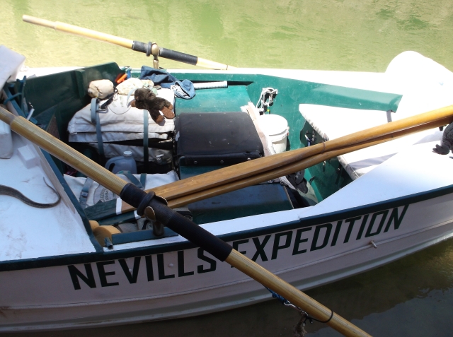
We got back on the boats and ran Unkar Rapid, class 4-7 with a  drop of 25 feet, with Julia Rose back in the fish-eye position. And then we stopped at Escalante Canyon and took a long hike, two miles round-trip, up Escalante canyon. The canyon opens onto the river in a wide graveled creek bed, and winds up through narrowing walls to a box canyon, where we practiced some rock climbing to get up to the next level of canyon. After a bit of exploring we sat in whatever shade we could find to listen to Greg tell us the story of his grandfather and how he got started on the Colorado, and sadly, how he died in a small plane crash (he was a pilot as well as a river-runner). It was a moving experience to hear Nevills’ story, told by a grandson who exhibited the love and pride of his generations, and a real connection to the history and physical dimensions of the land he walked on and the water he floated. Listening to Greg’s story in the canyon and later, pondering it while sitting in the boat his grandfather built and Greg tediously reconditioned, I felt a connection to the canyon and the river that I don’t think I would have gained from any other experience. It makes me happy that in this age of bottom line economic and business models, that Greg is able to tell his family’s history and share his grandfather’s boat and I admire his continuation and fulfillment of the tradition. Hearing Greg yell his grandfather’s name in the rapid named after him provided me with a true sense of historical connection. It made me feel like I had been invited into a sacred space.

DSCF1517DSCF1519DSCF1521DSCF1523DSCF1524DSCF1529DSCF1530DSCF1532DSCF1533DSCF1534DSCF1536DSCF1538

Julia Rose got to fish-eye Nevills, a class 4-7 with a 16 foot drop (accented by Greg’s yelling out his grandfather’s name in memorial), but then we stopped to scout Hance, one of the bigger rapids of the trip so far, a much more technical class 7-8 with a nasty hole at the top and some big waves and a drop of 30 feet. It was my turn to fish-eye, my turn to throw my body around “like a linebacker” to keep the boat upright in the wettest ride of my white-water experience. It’s a limited view–your neck can only crane back so far when you’re kissing the deck, as the boat climbs roller coaster waves to the top, where you get a split second view of the rapid and the wave-train ahead, before plunging back down into the next trough. There’s no chance to anticipate the run, only to throw your body from side to side, sometimes extending head and shoulders beyond the perimeter of the deck and out over and into the water.

After Hance there are a couple of short ripples, and then “Sockdolager,” a well named class 5-7 with a 19 foot drop. Sockdolager is a word that can be dated back to use in the 1830s, which means “something unusually large or heavy,” or “a forceful, finishing blow,” as in finishing a fight. Below Sockdolager I switched back to the rear of the boat and let Julia Rose finish the day fish-eyeing. The last section of the day featured a good mix of rapids in a section of the canyon with close walls and some wild-looking fins protruding from the rock walls. Julia Rose ran Grapevine (class 6-7 and a 17 foot drop) in the fish-eye, and in the smaller rapids that followed, I was able to shoot video with my compact fuji camera. Greg, knowing I was filming, took us into the wave train of one of the rapids without warning Julia Rose (he tended to cheat the bigger holes in his small boat) and Julia Rose got a great ride on film. We finished out the day with some good fun rapids, including 83 Mile rapid, Zoraster, and Clear Creek, along with some good ripples.

Greg Reiff

DSCF1550

DSCF1546

DSCF1555

We finished the afternoon camping at Upper Cremation campsite. Julia Rose and I pitched a tent in a small sandy patch between boulders, up on a hill overlooking the landing site. The guides grilled steaks and made garlic mashed potatoes, and Terry and Amy told us about how they met years ago (the next day was their anniversary and they would be on the Sandra). They met back in the late 70s, when Terry spotted Amy driving on the highway and fell in love and followed her to a rest stop, where they chatted away the afternoon and made plans to meet on a later trip–she was returning to college dorm after a weekend trip). The guides made a deal out of saying goodbye to those of us who were hiking out the next morning (Julia Rose and I, and Ed Zifkin and his wife Sue, and their children Elena and Ben, who had both just graduated from college that spring); 5 new boaters were hiking into the canyon to continue the rest of the trip. It was sad to be be leaving the group without being able to see the rest of the canyon and share it with these people who we had become friends with very shortly. The guides pointed out (truthfully, I belive) how much they had enjoyed rafting with us all. It was a good group with good grace and small egos–everyone was friendly and unselfish and no one thought they were more special than anyone else on the trip. The monsoon season was coming on and it sprinkled and showered off and on all night. It was really too hot to be in the tent, but too wet not to be in the tent. A private group camped at Lower Cremation campsite, about 50 yards downstream from us, and they spread tents all over the hillside above their beach, yelled at one another, and played loud music for much of the evening before finally settling down for the night, proving that even in the Grand Canyon you can’t completely get away from assholes.  

The Grand Canyon/Colorado River Oar Trip: Day 5, Part I


DSCF1045

July 18, 2017

On day five Julia Rose and I awake eager to begin our day on the Sandra. We have an easy job of packing up for the morning, since we don’t have a tent to break down, and after breakfast and helping load the rafts, we go wait for Greg to give us our special instructions for passengering on the Sandra.

DSCF1444

Lee’s Ferry, AZ, August 2016–The story of the Sandra goes back over a year before this day. A few years ago my wife and I made the decision that for their 16th birthdays, our daughters could choose a trip anywhere in the continental United States. Last summer, just after Julia Rose turned 15, our family was heading home following a vacation to Colorado, Utah, and Arizona. We stopped off at Lee’s Ferry so I could finally see the legendary put-in I’d read about for so many years. There were several groups getting ready to go down the river. A couple of private boaters had oar rafts rigged and ready to float, and there were some commercial trips getting ready. I watched a woman swamper rolling out a massive raft and inflate the air chambers, and I talked to one of the guides getting ready to take a group of scientists and elected officials, along with members of an American Indian tribe with cultural connections to the canyon gear up. Since it was late in the day the guides were rigging out the boats in preparation for a morning launch.

IMG_2987

Rigging a large motorized passenger raft at Lee’s Ferry, 2015

As I was Geeking out over the rafts, talking to guides and crew outfitting their boats, and explaining to Julia Rose what I knew about the river and the trips that went down it, she made the decision that she wanted to raft the Grand Canyon for her sixteenth birthday. The decision made me happy, since it meant that I would get to accompany her and finally get to live one of  my dreams.

01583   Grand Canyon Nat Park: Historic River Photo

Norm Nevills at Bright Angel Beach, 1947 (courtesy Wikipedia)

As we headed toward home across Arizona, my wife scrolled through her phone, reading descriptions of the trip options for the following summer. As a boater, and as someone who knew that this might be my one chance to see the canyon from river level, I rejected trip after trip. Most of the trips were motorized, giant passenger rafts. I didn’t want the silence of the canyon to be marred by the sound of motors, and I didn’t want to sit on a giant raft like a passenger on a tour bus.  I wanted Julia Rose to experience the river on a smaller boat, where she could feel the size of the waves and get wet, where she could come to appreciate the artistry of a guide angling the boat into the waves and holes, where she could bail and pump water after a rapid, where she could experience the potential danger of a flipped raft and a cold swim, and where she could take in the wonders of the canyon, quietly reflecting on the flat sections, and talk to a guide one-on-one, and listen to his jokes and stories and take a turn on the oars in the slow water. I reasoned, correctly, that we were much more likely to encounter a higher quality of fellow clients on an oar trip–people like us who appreciate quiet wanted to engage with the river on a more personal level. As we drove, we focused in on the oar trips (much fewer than I anticipated), weighing options.

Lisa finally read a description of the upper canyon section of the river slated for mid-July, a trip that featured oar-rafts and no motorized support for the gear. The detail that sealed the deal, the one sentence that led me to choose Canyoneers, and our particular trip, was the fact that it featured a historic cataract boat built by Norm Nevills.

I didn’t remember all the details about Nevills, about his running the first commercial trips through the canyon and taking the first women end to end, but I knew the name from having read a book, over 30 years earlier, titled River Runners of the Grand Canyon. Off and on through the years I had studied the history of river running through the canyon, beginning with Wallace Stegner’s Beyond the Hundredth Meridian and the explorations of John Wesley Powell,  and tracing its history all the way to the young adult fiction of Will Hobbs and his book Downriver. Over the years I have marvelled at the courage, audacity, willpower, grit, foolishness, cleverness, and pride of those first men who built wooden boats and pushed them into the river. The opportunity to touch a bit of history, to experience the rapids in a handbuilt boat, to feel the movement of the river in the same way that some of  the earliest runners had felt it, was the only way that I could imagine my (for all I know) once in a lifetime Grand Canyon run.

nevills cataract

We booked the trip while driving across Arizona, and I began to plan and dream. I even gave Julia Rose Riverrunners so she could read up on the history and have an appreciation for just what a trip through the canyon promised.

Throughout our early days in the canyon, Julia Rose and felt a real sense of anticipation as we watched others ride the Sandra ahead of us and waited our turn. I don’t think we could have picked a better day to ride the Sandra. It’s a small boat, probably 14 feet, made out of marine plywood and painted white with green trim. It has a regular prow and a square stern, but it’s designed to float square stern down river. Otherwise, the current would push the square stern making the boat difficult to maneuver. Like all river runners, Greg has outfitted his boat to suite his personality, so the Sandra sports a variety of animal figures–from a plastic Gila monster to a Teddy bear (to remember his son while he’s away on the river)–lashed to the deck and cockpits. Inside a waterproof hatch, there’s a picture of his grandfather and grandmother in a cataract boat, laminated and glued to the inside hatch cover.

DSCF1046

Cockpit for the pilot and the second passenger

In operation, the guide sits in the middle of the boat in a little cockpit, and one passenger rides in a second cockpit  immediately behind the pilot. This passenger operates a bilge pump and bail bucket and gets a bird’s eye view of the rapids over the guide’s shoulders. The second passenger rides on a mat strapped to the deck in front of the guide, and in the rapid has to lay prone on the deck of the boat, legs spread out in a V, holding on to two grab loops at the front (stern) of the boat. The front passenger’s face is just above the water level, since the boat only has a foot or two of freeboard above the water line. In the big rapids the front passenger gets an eye-level view of the waves, and a very wet ride. As Greg explained, the front passenger has to pay attention to the holes and troughs in the river and throw his or her weight on the downriver side to help prevent the boat from flipping. Nevills called this “fish-eying.”

fisheyeing

Fish-eyeing

DSCF1447

dscf1450.jpgDSCF1451


The Grand Canyon/Colorado River Oar Trip: Day 4

July 17, 2016

20160717_063040

Packing up for the day

20160717_063047

Sunrise at Lower Saddle Campsite

20160717_063053

Daylight at Lower Saddle

Julia Rose and I had originally scheduled with Greg Reiff to passenger on the Sandra, today, the short, wooden cataract boat built by Greg’s grandfather, Norman Nevills, one of the first commercial boaters in the canyon. It only takes two passengers, and Greg likes to get as many people on the boat as possible on a trip so that they can have a real historical perspective on boating in wooden boats. However, the day before, Ethan had warned us that Day 4 was much like Day 3 in terms of lack of big water and excitement. One of the reasons to ride on the Sandra is the excitement afforded by lying face down on the front deck, face just above the water level, holding on with two hand straps, and crashing through the rapids–Nevilles and Greg call it “fish-eyeing.” So the night before, I asked Greg if it would be okay to delay our time on the Sandra a day, since Day 5 promised lots of big rapids. Greg accommodated and let a more timid couple ride that day, and we teamed up with Terry and Amy and Don on Ethan’s raft.

20160717_063713

River guides’ solution to the wear and tear of the desert on sandaled feet

Terry and Amy are Arizona natives making their third trip down the canyon, and they will be celebrating their 36th wedding anniversary on the river (by design, actually riding the Sandra). Terry is a retired engineer for the state and Amy a second or third grade school teacher. They’ve left Arizona and moved to Oregon, near Bend, and they’re a very cool couple. Terry likes to hike and we chatted a good bit on various hikes. Amy is gregarious and funny, easy to tease and teases back. It was a relaxing day on the boat because there was time to talk and observe the canyon while Ethan rowed. They will celebrate their anniversary on Day 6, the day we climb out of the canyon, and that is the day they’ve reserved for the Sandra. Terry and I had hiked together for a while going up Saddle canyon the day before.

We’re surprised to learn that Ethan is younger than he looks, though he looks fairly young. I would have put him in his late 20s, but turns out he’s still in his early 20s and has been working the river since he was 17. The guides on the equipment boats are apprentice boaters, working for tips and experience. Ethan worked his way up pretty quickly, due to his skill with the boat, which is obvious, and his easy-going personality. He’s a good leader. He tells us that when gets off a long river trip he always takes in an afternoon movie to soak up the air conditioning and the dark of the theatre.

The morning broke clearer than day 3, with little trace of smoke. We weren’t sure if the fire had burned itself out or if the wind had shifted or if we had just paddled out of the downwind stream. It turned out to be the latter of the two, since the fire was still burning weeks after the trip ended. Not long after we got on the river we passed Nankoweap Canyon and one of the bigger rapids of the day, Nankoweap Rapid which drops 25 feet through a long, sweeping left hand curve–lots of splash and quite long, but not very technical. High above the river under an overhang of the cliff the ancients built pueblo style granaries that dates back to 1100. The overhang had been walled off with tightly fitted adobe bricks, which formed rooms that held grain and seeds and protected them from rodents and decay. From the river four rectangular windows are clearly visible.

As we floated Terry and Amy told stories about their kids and each other. A motorized oar rig passed us and Amy knew someone on the other raft, someone she had taught with before, so it prompted a shouted exchange and kept Amy telling stories about her friend for a few miles.

20160717_105057

lunch stop

The highlight of the day was an afternoon stop at the confluence of the Little Colorado River. Because of the high alkaline content and other minerals the water is eye-hurting turquoise blue. We hiked up the upstream bank of the Little about a quarter mile where a nice fast chute of water poured through a narrows. We took turns floating the chute in our life jackets, and in between swimming we rested under the shade of an overhang. Some of the rafters hung out beside some big boulders and made handprint designs by dipping their hands in the mud and laying them on the rock.

20160717_121632

Confluence of Little Colorado River and the Colorado


20160717_121931We camp at Upper Tanner, which is a wide delta where the cliffs draw back from the river and we get the sense of wide desert, the feel of being hemmed in by the canyon forgotten for the evening. Julia Rose and I pick out a campsite below a short cliff  near the boat landing, but decide to move further away from the rocks  after watching a long thin snake cross our campsite and disappear into some brush on the other side. Clearly his territory, and while non-poisonous, unsettling enough to encourage us to move.

20160717_172204

Looking across the valley from Tanner

Greg Reiff leads a group on a half mile hike to get a close up look at “Newspaper Rock,” a cluster of rocks on a hill that have dozens of petroglyphs carved into them. The site suggests that the area was heavily visited, most likely farmed hundreds of years ago, and important for whatever ceremonial, spiritual, or communal reasons that can be inferred. A teacher by trade, Greg establishes rules about not touching anything, but then leads the group in thinking about the importance of respect for cultural artifacts, comparing the site to the churches, temples, and synagogues of the Western and near-Eastern worlds. Sitting on the rocks near “Newspaper Rock,” we have a nice view of the river and a wide valley within the canyon.

20160717_172829

20160717_172757_001


20160717_172957

20160717_173142

20160717_174116

Ed Zifkin, Greg Reiff (Sandra cataract boat), Erin Brugler (hike guide)

20160717_174122

Don Schumm, Ira Wagner, Amy Burks, Terry Burks

Don

20160717_174126

Terry Burks, Glenn Sherratt, Sue Feldman, Elena Zifkin

20160717_175232

Ed Zifkin, Chris Adakai, Erin Brugler

20160717_175427_000

The evening is windy, blowing sand, and after a supper of spaghetti and meatballs, Omar and Greg stop by our campsite for a little while. For some reason we end up talking about Racism and the deep South, which Omar can appreciate since he grew up in Virginia with a Nicaraguan mother. Greg was flabbergasted by the stories Julia Rose and I told about the pickup truck parades flying Confederate battle flags in reaction to the black church shooting in South Carolina and talks about taking the rebel flags off of Southern capitols and state flags. That such a thing is still an issue is a concept that Greg, a true Westerner, can’t seem to wrap his head around. Chris, a friend of Leo’s  sets up a dome tent, fearing rain, and while we talk, the canyon walls in the distance color and darken with the setting sun. Sure enough, during the night we get a heavy sprinkle and a few people break out the rafting company’s dome tents and set them up by headlamp. Julia Rose and I debate setting one up, but decide it’s too much trouble and the rain blows over before we could have gotten it set up anyway.

20160717_193054

Omar Martinez, Julia Rose, Greg Reiff

20160717_193156

Evening at Tanner


On the National Mall, Jan 1, 2017


IMG_4199

Lincoln Memorial


Delilah at Lincoln Memorial 2

On the step where Martin Luther King Jr. gave the “I Have a Dream  Speech”


IMG_4206

Korean War Memorial 1

IMG_4207

Korean War Memorial 2

IMG_4208

Korean War Memorial 3

IMG_4209

Korean War Memorial 4

IMG_4213

Vietnam War Memorial

20170101_194202


Walking Train Tracks on Superbowl Sunday

20170205_150553

February 4, 2017

It was a warm day for February, mid fifties with a mild wind and overcast skies but no rain. Mid-afternoon, I had an afternoon to kill, waiting for the Superbowl to come on tv, waiting on my daughter, who was dancing at the ballet studio all afternoon and into the evening, (halftime to be exact, before she finished and we could make the hour drive home; she wanted to watch Lady Gaga, so we sat in the lobby of the studio for another fifteen minutes and watched the spectacle).

A couple of miles from the studio Two Rivers Park sits at the junction of the Little Maumelle River and the Arkansas River. There’s a big parking area, a boat ramp, and a bicycle/pedestrian bridge that crosses the mouth of the Little Maumelle and connects the Two Rivers trail to the Arkansas River Trail, which runs all the way downtown on the south side of the river and splits to cross the Big Dam Bridge and run into North Little Rock on the north side of the Arkansas. It being Sunday afternoon the parking lot was full and the Two Rivers trail, paved for bicycles, was busy. Railroad tracks ran west, toward cone-shaped Pinnacle Mountain in the distance, the tracks squeezed between a steep bluff and the Little Maumelle River. Opting for time away from crowds, I followed the tracks and soon found myself alone, following the curve of the rails as it paralleled the curves of the river.

I’ve got a history with railroad tracks dating back to my early teenage years, when a friend and I used the tracks near his house to get out of the neighborhood he lived in and into what passed for near-country despite being in the middle of a mid-sized Mississippi town. We’d lay our ears on the rails and try to detect approaching trains, like American Indians or train robbers in the movies, but never really heard anything even when we could see the big diesel engines a quarter mile down the track. We’d lay coins on the rails and wait for the train to flatten them into silver and copper pancakes. We’d collect rusted railroad spikes and look for blue-glass insulators at the base of utility poles that often ran beside the tracks. The benefit of railroad tracks is that they usually go cross-country, where highways and streets seldom seem to go. Unlike cars, trains don’t need to stop, or turn off or lead to houses or businesses, so in just a few minutes of walking, it can feel like you’re miles from nowhere. Traffic noises dissipate, trees crowd up close to the right of way, and the gentle curves provide an incentive to find out what’s around the next bend. Walking the rails, I’m reminded of Hemingway’s young hero Nick Adams, walking the rails and riding the trains to get away from something, or to get somewhere new and promising.

In college I rented a room in a house that sat on the edge of town. Behind the house railroad tracks led off into the country, and beside the tracks for a long way was a nice creek with steep banks and wonderful hardwoods. Across the creek stretched the experimental farmland of Mississippi State University’s College of Agriculture, several hundred acres. Afternoons I would gather my books and head off down the tracks and walk as far as I wanted until I found a nice place to study in the woods that sheltered the creek.

Despite the peaceful setting, passing trains never failed to excite the little boy inside of me. The deep throb of the diesel engines, the wave of the engineer, the screeching metal-on-metal of the wheels, remind me of the excitement Walt Whitman felt in his poem, “To a Locomotive in Winter”:

. . . .
Fierce-throated beauty!	 
Roll through my chant with all thy lawless music, thy swinging lamps at night,
Thy madly-whistled laughter, echoing, rumbling like an earthquake, rousing all,	  
Law of thyself complete, thine own track firmly holding,	 
(No sweetness debonair of tearful harp or glib piano thine,)	 
Thy trills of shrieks by rocks and hills return’d,	
Launch’d o’er the prairies wide,across the lakes,	 
To the free skies unpent and glad and strong.

Although there were no trains running today, it was pleasant to be outdoors. The Little Maumelle, about 40 yards wide at the mouth, narrowing to twenty by the time I had hiked two miles, barely registered a flow as it was backed up behind Big Dam Bridge. But the tracks were covered in fallen leaves, oak and hickory, and fat acorns had dropped between the ties. I tossed a few tie spikes and some rusted bolts into the river to hear the deep splash. The bluff towered above me on the left, a couple of hundred feet in places, and at the end of my walk I came upon a small marina on the far bank, with a tiny houseboat built on a small barge, and I watched a fat dog waddle down the gangplank onto the boat. In the marina a pontoon boat sported a confederate flag. I turned back toward the park where my car was, and as I walked back a few squirrels scampered across the tracks and up on the ridge a deer walked through the trees, silhouetted against the sky behind him.


Thanksgiving Backpacking at Hurricane Creek Wilderness Area

20161121_115108

November 19-22, 2016

Hurricane Creek Wilderness Area

Ozark National Forest, Arkansas

20161120_150839

Hurricane Creek

Julia Rose and I undertook our second annual Thanksgiving Holiday Backpacking trip this year, again choosing the Ozark Highlands Trail. Our destination this year was a section that took us into the Hurricane Creek Wilderness Area, about 45 miles northwest of Russellville, Arkansas. We parked beside the Big Piney River and hiked in five and a half miles to camp beside Hurricane Creek.

The Ozark Highlands Trail runs 218 miles across Northwest Arkansas, from near Fort Smith in the West to the Buffalo National River. Last year we had tried the Richland Creek Wilderness, a few miles to the north, but after reading several reviews of the section through Hurricane Creek WA, believed by more than a few sources to be one of the most scenic parts of the Ozarks, i wanted to see for myself.

We started out on a Sunday morning, driving about two and a half hours to get to the trailhead. A few miles into the drive I realized I’d left my hiking boots in the dining room where we’d packed our backpacks. The temperatures were expected to fall into the low 30s, but it wasn’t supposed to rain until sometime during the day of the hike out, so I stopped at a Target and bought a couple of extra pair of socks and decided I’d be okay in my Tevas for such a short trip.

The trail starts beside the Big Piney river, a river with promising whitewater when there’s enough rain. I’d paddled it a few times in the 80s, but we’ve had very little rain in the last couple of months, so the river was barely a trickle. The drought has kept the fall colors down as well, and put a few counties on burn bans, but we finally got some rain the week before and it snapped the  leaves to life, generating a last gasp of fall color, and wetted the woods enough that we had trouble keeping our fires going during our trip. Last year at Thanksgiving, the leaves were completely off the trees, which created wonderful vistas, but covered the trail like snow, making it difficult to pick a path among the ankle-rolling rocks that lined the trail. This year, the trail, though sparsely marked by blazes, was clear enough to follow and easier on the ankles.

20161121_153034

Beech leaves.

20161121_153205

The trailhead started with a mile and a half of switchbacks which led us mostly to the top of Wheeler Ridge, a climb of about 850 feet, before leveling off for three miles, and then dropping steeply the last mile into the Hurricane Creek watershed. The skies were clear blue and sunny, and the temps somewhere in the 50s, which made hiking comfortable. Our only problem was that the middle mile markers were missing, which gave us a little concern since we’d never been on that section of the trail before, and we’d frequently go several hundred yards without blazes to mark the trail. Most of the ridge was beech forest, a hardwood tree whose leaves tend to turn a lovely yellow color in the fall before, but rarely drop from the tree until late winter. Most of the winter they are a beautifully symmetrical brown in the shape of a paddle blade.

20161121_112021

The trail follows and old “pioneer” road for a distance.

20161121_112037

My arthritic knees held up during the climb and the level hike, but the descent into Hurricane Creek was painful. We hit the creek bottom with a couple of good hours of light left and made a nice camp beside the creek, which was about thirty feet wide and rocky, with canyon walls rising steeply on both sides. The camp had a well built fire pit and someone had stacked flat rocks with backrests beside the pit, so it was fairly comfortable. Julia Rose and I set up our tents, gathered firewood and settled in for a cold evening. We cooked tacos for supper pumped water for our bottles, and fought to keep a smoky fire burning for a couple of hours, but following a long semester and a long week, not to mention a good hard hike, we were both ready to move into our tents and our sleeping bags and read for a while before going to sleep. The temperature, around 30 degrees, was right at the limit for our sleeping bags, which are light weight backpacking models supplemented by fleece liners.

For breakfast we restarted the fire and cooked burritos with bacon, scrambled eggs, and cheese. We enjoyed the fire and read for a while, waiting for the day to warm a bit. I’ve always insisted on having a good book while backpacking, despite the weight. For Julia Rose, she spent the weekend in Jackson Mississippi during the Civil Rights era, reading The Help. For myself, 1923, wandering the streets of London looking to buy flowers with Virginia Woolf’s Mrs Dalloway. We spent the early afternoon exploring the opposite side of the creek, hiking up to get a look at Hurricane Creek Natural Bridge (complete with a pulpit rock) and then lunch on a nice reading and contemplating rock in the middle of the creek. We closed out the afternoon relaxing around camp, enjoying hot chocolate and a warming fire as the temperatures fell. The night was warmer, closer to 40 degrees than 30, and we awoke to  a light sprinkle of rain tapping at the tents.

20161121_114935

Hurricane Creek Natural Bridge–Difficult to spot from the trail.

20161121_115015

Closeup view of the Natural Bridge–I might be more inclined to call it an arch, since in the west “bridge” means a span across a waterway. Not the case here.

20161121_114607

A walking stick (perched on a walking stick) still numbed by the low temperatures of the night before.

20161121_12400220161121_12415720161121_12425620161121_12455120161121_12483320161121_124847

The morning was overcast and smelled of rain. We breakfasted, burritos again, then broke camp and packed, for the hike out. The climb to the top of Wheeler ridge was tough, but we made good time on the hike out through intermittent showers. Overall, this was my favorite part of the hike, walking through wet woods, since the damp makes walking on leaves quieter, but the moisture brings out the deep smells of earth and decaying leaves and the tannins and lignins and bacteria and microbes carried on the denser air. We got back to our car and drove home in damp clothes, enjoying the feel of the heater warming our toes and flowing around us. We stopped in Russellville at the legendary Whattaburger drive in, across from Arkansas Tech, for burgers, fries, onion rings, and a cold Diet Coke and a strawberry shake for the drive home.

Colorado River through the Grand Canyon: A Photo Essay

I’m still working on my reflections of the summer trip through the Grand Canyon. Here are a few random pictures that I haven’t shared yet. More detailed journals of the trip will follow soon.


dscf1060

Julia Rose scouting the rapids on day 1.

dscf1066

Collared lizard

dscf1200

dscf1103

dscf1229

Early morning shade.

dscf1299

Lunch stop.


The Grand Canyon/Colorado River Oar Trip: Day 3, Part 2

dscf1288

July 16, 2016

The stretch between Sandpile campsite and Saddle Canyon is relatively flat, with few rapids and none of any real consequence. What keeps our attention at lunch and during the afternoon is the growing cloud of smoke coming off of the North rim Fuller Fire, which started from lightning a few days before our trip began and which closed some areas at the North Rim park where Lisa and Stella are staying. (They will tell us later that there was a heavy firefighter presence in the park, with choppers coming and going, and some road blockages.) The fire was initially located 3 miles west southwest of Point Imperial, and July 7 was only 1 acre. The NPS elected to let it burn in order to clear out accumulated fuel and prevent a larger scale fire in the future. As of July 29 the fire had affected 14.5 thousand acres, with the NPS letting it burn because there had not been a “natural ignition” in over 200 years.

dscf1301

Smoke from the Fuller Fire begins to dominate the sky above the rim at the lunch stop.

dscf1303

Under the canyon rim at lunch.

The fire is only been a few miles away from where we are boating, but up on the rim, and the constant change of direction caused by river bends keest us close to the downwind smoke. The smoke builds all day long so that at lunch the sun barely shines through the haze, turning it bright orange, and big pieces of soot fall on us as we floated. At times a thick pall of smoke hangs above the river, bringing up many allusions to the surreal scenes in Apocalypse Now where a thick smoke haze covers the river, making it almost impossible to steer. If it had been an actively fought fire, though, chances were high that we would have seen choppers coming to the river to scoop water to fight it.

dscf1309

dscf1314

Although the smoke never gets so bad for us that finding our way down the river is an issue, we did have a good time conjecturing where the fire was and how big it was, and tossing out Apocalypse Now quotes: “Never get off the boat!” “Got to be some mangos around here somewhere”; “Do you want to raft or fight?” and, “Grand Canyon: Shit” (the last one I thought, rather than said, since my daughter was sitting next to me on the raft). As always, when Julia Rose finds me in the rare company of movie-literate people who get my quotes, she is always surprised, suddenly seeing me in a different light.

dscf1316

dscf1318

dscf1331


dscf1347

dscf1348

In addition to the smoke, we begin to see a few clouds, where before there had been pristine blue sky. According to Ethan, it might be the signal of monsoon season coming on, a July/August phenomenon where moisture gets funneled up from the gulf of Mexico and brings rain.

dscf1334

Ethan fights the wind a good bit of the day. At times he has to point the back of the raft downstream and just flat out row to make any progress at all. We camp for the evening around mile 48, at Saddle Canyon in a big eddy that separates the upper and lower campsites. A motorized raft group has the Upper Saddle Beach, and we take Lower Saddle.

dscf1356

After setting up camp Omar leads the group on a long hike up Saddle Canyon. It’s 4.5 miles round trip, and we climb pretty steadily and gain a few hundred feet in elevation quickly. It is a good test for my knee.

dscf1360


dscf1361dscf1364At first we walk beside the creek, then cross it several times, and in sections have to wade upstream. The temperature cools (if you want to call high 90s or low 100s cool) as we are in the shade of the canyon walls and the canyon itself sprouts lots of vegetation, including trees and shrubs like Western Redbuds, Coyote Willow, Mesquite, Cat’s Claw (the “wait-a-minute” bush, because the thorns snag clothing and force walkers to stop and disentangle themselves), and Netleaf Hackberry, adding to the deepness of the shade.

dscf1367

The smoke dissipates as we climb higher, and we pass through desert scrub into a slot canyon that narrows as we climb higher.

dscf1371

dscf1372

dscf1378

We end up in a beautiful slot roughly 6 to 8 feet wide and blocked off by a high cliff. We dip in the waist deep pool and relax on the rocks for a while, before beginning the long walk back, where we get to camp just before supper: Beef and chicken tamales, quesadillas, and rice.

dscf1377

dscf1383

It’s a tiring day–the combination of sun and smoke and long slow floating with few rapids to break up the slow pace leave us tired. I’m too tired to journal and almost too tired to read. I can usually manage a few pages of Edward Abbey’s Desert Solitaire, appropriate for Canyon country, before getting sleepy, so I switch to Farley Mowat’s And No Birds Sang, a memoir of the Canadian forces invasion of  Sicily and Italy during WWII. It’s a change of pace from the canyon and I hope it will keep me interested enough to stay up a little later and wait for the heat to lift. I know Desert Solitaire by heart, so I don’t feel cheated. I’m not the only one with an Abbey book on the trip. Elana, the girl who’s just graduated college and has befriended Julia Rose, is reading The Monkey Wrench Gang, though she has just started and we never really get a chance to discuss Abbey. The raft guide Dave says it’s an unusual trip when no one brings Abbey to read.

dscf1228

The Grand Canyon/Colorado River: Day 3, Part 1

July 16, 2016

dscf1237

Ethan, the trip leader, at rest.

dscf1212

Guides at rest after a day of rowing; the kitchen area is unloaded, but not set up yet.

For Day 3 we follow the established wake up and breakfast routine, then pack and load the boats. Today we ride on Ethan’s boat. Ethan is the trip leader, and since we haven’t been on his boat yet, it’s been a bit hard to get a good read on him. He’s young, and later on the trip I’ll be surprised to find out he’s only 24. He’s been working on the river for the past 7 years, starting as a swamper and working his way up to trip leader. He is quiet in camp, though not on the boat, good natured, calm, and extremely competent on the oars. He tells some good stories about the various trips he’s been on, including a trip with Jane Fonda’s daughter, and another trip with an honest-to-god crazy woman in full-blown crazy. He’s got a good sense of humor.

Riding with us, we get Ken for a second day, keeping busy snapping photos and telling stories about the Everglades and other places he’s visited. In the back of the raft ride Cory and Laura, a heatlthy-middle-aged couple who have only been married for a year or so. They are an easy going couple, fairly athletic, and good camping companions. Laura straps on a  whitewater helmet with a Go-Pro camera strapped to the top for filming the rapids.

dscf1238

Climbing up to the Puebloan dwelling site.

dscf1240

The best part about riding in Ethan’s boat is that we are first on the river, and first at whatever stops we make. We push off a bit early while the swampers finish loading the Duke and the rest of the kitchen gear and float a short distance to an ancient American Indian site. We beach the rafts and climb steep trail up a short cliff to a bench of land a couple hundred feet above the river, where Ethan leads us to the outlines of a couple of small structures, rock wall foundations laid out in rectangles, along with some petroglyphs and small flakes of turquoise, which was apparently traded from Mexico and other faraway locations. The structures themselves are smaller than 10 x 10 feet, and there are no higher than a couple of levels of rock. Ethan tells me that there are some more dwellings in the cliffs above us, but it would be a good hike. He had worked here before, for several days, helping a group of archaeologists from the National Park Service catalogue the sites in the area. The NPS used to run their own boats and employee their own “boatmen” on the river, but they’ve taken to using commercial companies because of problems with the boatmen (more to come on that topic).

dscf1243

On the bench, looking at the ruins.

Ethan fills us in on what the archaeologists know about the people who built these structures. The sites we’re looking at date to around 1100 AD, but the ancestral Puebloan people probably came to the area around 800 AD, according to the Grand Canyon River Guide. Good weather allowed for a fairly heavy population to farm the interior of the canyon, and the sites we are seeing are evidence of a shift from living in shallow pit houses. But these remains were probably above ground pueblos. According to the guide, “the pueblo people constructed hundreds of living sites containing single-to-many room dwellings, religious structures, rock-terraced agricultural fields, cliff graneries, rock-lined roasting pits, petroglyphs, and pictographs.” The sites we are seeing allowed the puebloan people to cultivate larger fields on the benchlands and avoid the spring floods of the river.

dscf1257

Ethan shows us a rock the size of a compact car, where the surface is etched with petroglyphs. The rock itself is pretty exposed, so the pictures are weathered.

dscf1256

One of the guides tells us about a spiny plant called Mormon tea, which contains the chemical ephedra. Apparently, you can get a bit of a boost chewing on it, which Ben (who will try about anything) tries. We are also shown the difference between the century plant, a spiny agave with a tall flower spike which blooms creamy white flowers once every 20 – 40 years and the Soaptree yucca. These plants occur in the desert scrub zone, but along the river bank in the riparian zone we are seeing the invasive species tamarisk, which looks similar to the mesquite, along with western redbud and various willow, and right on the beaches the cane-like horsetail, or scouring rush, which the Ancestral Puebloans used to blow pigment against rock faces to paint pictograhs.

mormon-tea

Mormon Tea

century-plant

Century Plant (on right)

soaptree-yucca

Soaptree Yucca

Back on the rafts, we float a bit further and pass Vasey’s Paradise, an Eden of plant life clinging to the wall of the canyon, fed by a spring emerging from a hole in the wall and fanning down the rock. John Wesley Powell named it in August, 1869, writing, “The river turns sharply to the east and seems inclosed by a wall set with a million brilliant gems. On coming nearer we find fountains bursting from the rock high overhead, and the spray in the sunshine forms the gems which bedeck the wall. The rocks are covered with mosses and ferns and many beautiful flowering plants. We name it Vasey’s Paradise, in honor of the botanist who traveled with us last year.”

vaseya-paradise

Vasey’s Paradise

A mile later we come to Redwall Cavern, a football field sized overhang cavern, deep, sandy, with a ceiling close to a hundred feet at the opening and sloping down to  six or eight feet at the back. There are a couple of motorized raft trips (massive rafts holding around 20 passengers and a couple of guides) already tied up, and a group of people playing Frisbee.  I throw Ethan’s frisbee with Cory and Laura, then we just hang out and watch the guides try to climb the horizontal ceiling of the cavern where it sloped down to the back wall. Gregg, the guide who rowed the Sandra, showed us some fossils in rock.

dscf1268

Redwall Cavern

dscf1275

dscf1278

dscf1281

Omar in action in Redwall Cavern

A bit further down the river, at mile 40, we see the remnants of plans to build another dam in Marble canyon in the form of drill marks to test the strength of the rock in a narrow part of the canyon. There was little mention that they planned to flood the Grand Canyon, preferring instead to call it the Marble Canyon dam to avoid rousing public sentiment, but luckily the dam was never approved.

The Grand Canyon/Colorado River: Day 2, part 2


dscf1129

Desert Bighorn Sheep

Just above mile 21 we come to North Canyon (extending into the North rim of the Grand Canyon) and pull over at one of the campsites. The guides rig beach umbrellas to shade the ice coolers that they sit on, a regular practice whenever the boats are going to be exposed to the sun for any length of time.dscf1183

Since we are on a self-supported trip, we’re carrying everything the group will need for 13 days and the guides filter river water for drinking and cooking. Other trip options include a motorized raft for  gear and freshwater, but our gear rafts are being rowed by a couple of apprentices, Jason and Leo, who are training on oars before they can carry passengers, and working for tips rather than a salary. The coolers are actually packed over a period of time, in a freezer, so that that layers of ice are frozen between layers of food, and as the trip goes on, layers of food are exposed, sort of like peeling back the successive layers of rock that form the canyon walls themselves.


Ethan leads the group on a hike up North Canyon, which starts off about fifty yards wide, but steadily narrows and climbs up a series of short ledges. Often we go to the sides of the canyon to climb the walls to circumvent the higher ledges. It feels good to scramble on rock and make the short climbs necessary to get to the next level. (I’m reminded of the story Edward Abbey tells in Desert Solitaire, where he followed a canyon down from a rim, dropping off successively higher ledges polished smooth by flash flood, planning to hit the canyon floor and walk down to another trail that would lead him back to the rim. Eventually, he came to a drop off below a ledge that was too high to drop off, and the ledges above him were too high and too smooth to climb back out. He lived to write the story, so I won’t give away more here.)

dscf1138

dscf1140

The hike up canyon is a good test for my recently operated upon knee, which I’ve been worried about since January, wondering if I would be able to make the climb out to the rim on Day 6; however, Julia Rose and I keep near the front of the group. As we get deeper into the canyon the walls rise higher and draw closer together, and the terrain slowly transforms from a rocky desert wash to smoothly polished walls, worn into graceful curves by the sudden torrents of water flushed down the narrow canyon in flash floods over thousands of years.

dscf1145

dscf1149

We climb a last little cliff, about twenty feet high and find a pool of tepid water, about the size of a suburban backyard swimming pool, waste deep, shallow at the downstream end and deepening to a narrow rock slide that drops off a pour-over into the pool. We sit in the shade and drink our water and eat snacks provided by the guides, and then one by one about half the group begins to enter the pool. One of the younger customers, Ben, a recent college graduate, tries to rock climb the edge of the pool without getting wet, only to find the handhold cracks are the home of tiny canyon frogs, which depend on the pools of the side canyons and the river to breed and house their egg-masses and the hatching tadpoles. Julia Rose and a few other climb the slide at the end of the pool and go a bit deeper into the canyon, but progress is eventually walled off by a boulder strainer that completely shuts off further exploration.

dscf1168

dscf1155

Elana and Julia Rose

Julia Rose and Elana, Ben’s sister, also a recent college grad, slide down the rock and drop off into the pool, which is waist deep and refreshingly cool on a 110 degree day.

dscf1174

We hang out at the pool for the better part of an hour, until the sun finally clears the walls and drives us back to the boats for lunch–Dagwood style sandwiches (piled high with meat and vegetables). The guides teach Julia Rose and Ben and Elana a game called ”Pick three,” where someone creates a three ingredient gross out challenge. Julia Rose tries a combo of white onion, raspberry, and pickled carrot.

dscf1184

Pick three

After lunch we enter the “Roaring 20s,” marked right away by North Canyon Rapid and 21 Mile Rapid, both rated 4-5 with drops of 12 feet. The rest of the afternoon is filled with fun rapids, mostly “mile rapids,” including 23 Mile Rapid, 23 ½ Mile Rapid, Georgia Rapid, 24 ½ Mile Rapid, 25 Mile Rapid, Cave Springs Rapid, 27 Mile Rapid, and finally 29 Mile Rapid. In between 27 and 29 we get a stiff upstream wind, a usual afternoon phenomenon as the canyon warms up and the hot air convects upstream. There’s a term for it, called an anabatic wind. Whatever you call it, it’s hell on the guides trying to oar a high-profile, heavily loaded raft against a very stiff wind, but they do it with grace and good humor.

roaring-20s-1


In the evening we camp out at Sandpile, a huge beach which allows us to spread out a bit more than we had at the narrow rock shelf at Sheer Wall the night before. There’s a large eddy and a good sized sand bar in the river, and a lot of people take advantage to wash clothes and body. For supper we have Grilled Salmon, rice pilaf, and blackberry cobbler. Near twilight, some of the guides, their duties done for the day, take a raft out to float around the eddy and goof off and I suppose drink more beer. Julia Rose and I settle down on our tarps and sleeping pads for the evening. We get a good early moon and I get some fuzzy pictures of the moon over the canyon walls. Another warm night, but eventually, it cools off and sleep comes.

dscf1208